Winslow Route 66
|
Winslow has always been about going places, not standing on a corner. The high desert town has been a transportation hub since 1882 when the Atlantic & Pacific Railroad arrived.
Forty-four years later, Route 66 was designated, launching more than a half-century of motor travel through Winslow on the legendary cross-country highway. In 1929, the elegant La Posada Hotel was built along the tracks with a Harvey House restaurant serving passengers on the Santa Fe line, which had taken over from the Atlantic & Pacific. That same year, Charles Lindberg came to Winslow to establish an airport as part of the new Transcontinental Air Transport's coast-to-coast flights that made the trip in 48-hours. The original hangar from that early airline, which became TWA, is still a fixture at the Winslow-Lindberg Regional Airport. Trains, planes and automobiles Winslow was left behind by much larger airline hubs. Meanwhile, air travel and automobiles all but killed passenger rail, leaving Winslow without a key pillar of its economy after World War II. Route 66 became the so-called Main Street of America as post-war prosperity put families in station wagons driving out west to roadside attractions that competed for their attention along the highway from Chicago to Los Angeles. Winslow had its share of Indian curio shops, diners and motels lining Route 66 through town. It was one of the first towns to split Route 66 traffic onto a one-way westbound road and another one for eastbound traffic. By 1979, Interstate 40 replaced Route 66 and traffic through town slowed. Today, many businesses catering to travelers have fallen into disrepair, replaced by chain hotels and fast-food restaurants along I-40. But travelers can still see vestiges of the golden age of Route 66 in Winslow, including signs, gas stations and motels. That includes a cottage-style Phillips 66 station on Second Street and Williamson Avenue converted into a real estate office. On the east end of town, is a Route 66 rest area with a 9-11 Memorial. National Register of Historic Places report: http://bit.ly/2lAgpQ0 |
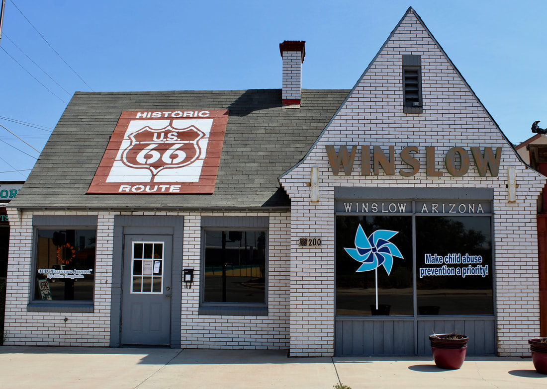
A Phillips 66 gas station operated out of this cottage-style building.
Fortunately, Winslow tourism got a major boost from two endeavors: a major renovation of La Posada Hotel in the 1990s and the creation of the Standin' on the Corner Park in the heart of town.
The park, highlighting the song “Take It Easy” by Jackson Browne and Glenn Frey, attracts a steady stream of travelers who take selfies while “standing on a corner of Winslow, Arizona.” The rock ’n’ roll monument really has little to do with Route 66 but it has become one of the must-see attractions for Mother Road roadies traveling across Arizona. Affeldt Mion Museum in restored depot Winslow got another shot in the arm in 2019 with the opening of the restored 1930 train depot in what's now called the Affeldt Mion Museum. A new modern gallery space has been added to the depot. Exhibits include the largest single-loom Navajo rug. The 695 square foot rug and museum have added to the burgeoning art scene linked to La Posada and other art spaces in town. It’s not unheard of to hear Winslow compared to Marfa, a remote west Texas town that's attracted artist refugees from afar. Affeldt Mion Museum is open daily from 9 a.m. 5 p.m. Admission is $5. It includes historical exhibits about La Posada and Santa Fe Railroad. The Hubbell-Joe Rug from 1937 is a permanent exhibit. Go west to Two Guns: www.ontheroadarizona.com/twoguns.html |
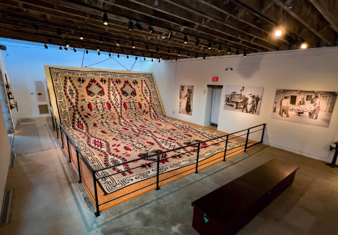
The Hubbell-Joe Rug, the largest single-loom Navajo rug, is in the Affeldt Mion Museum behind La Posada Hotel.
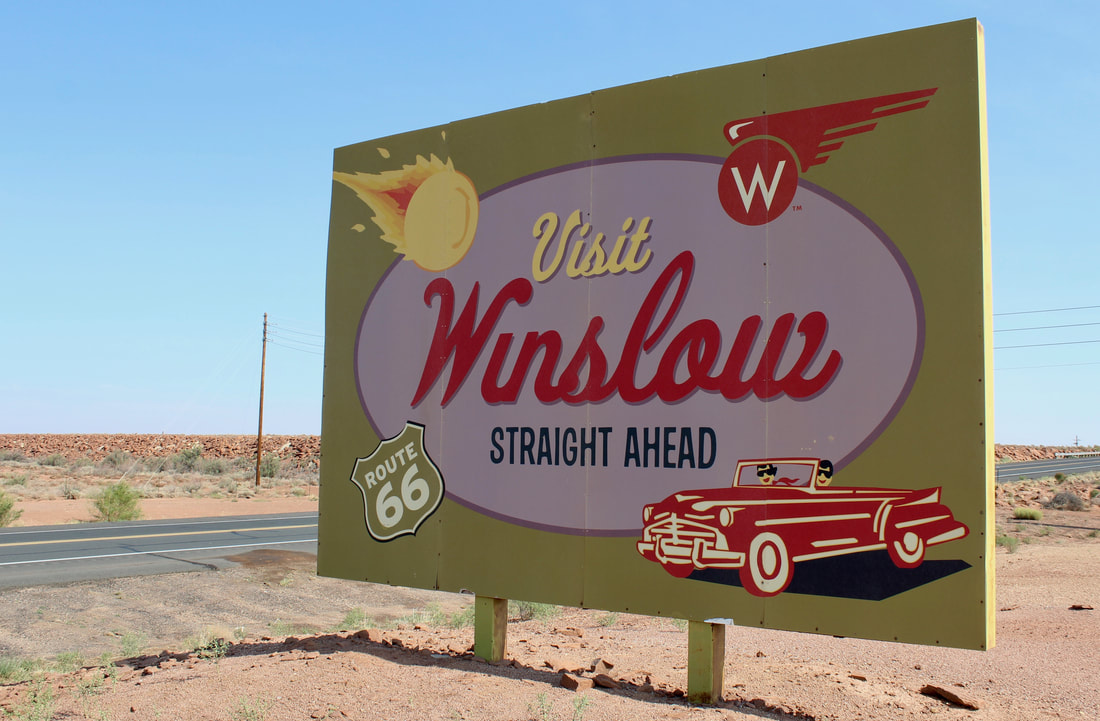
A retro sign about historic Route 66 greets travelers coming into Winslow on State Route 87 from south of town.
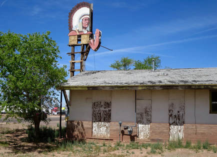
This Indian sign is gone from Route 66 on the east end of town.
|
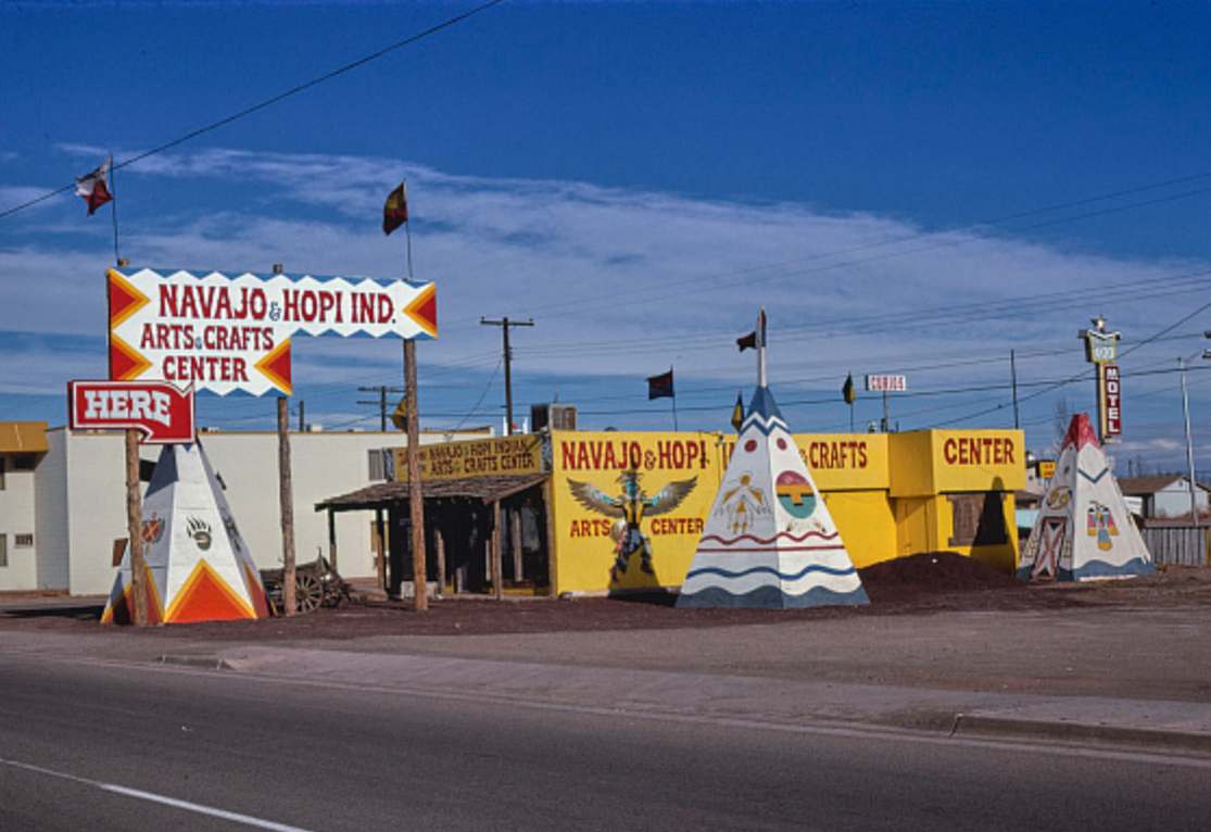
An Indian arts shop in 1979 in a photo by John Margolies. (LOC)
|
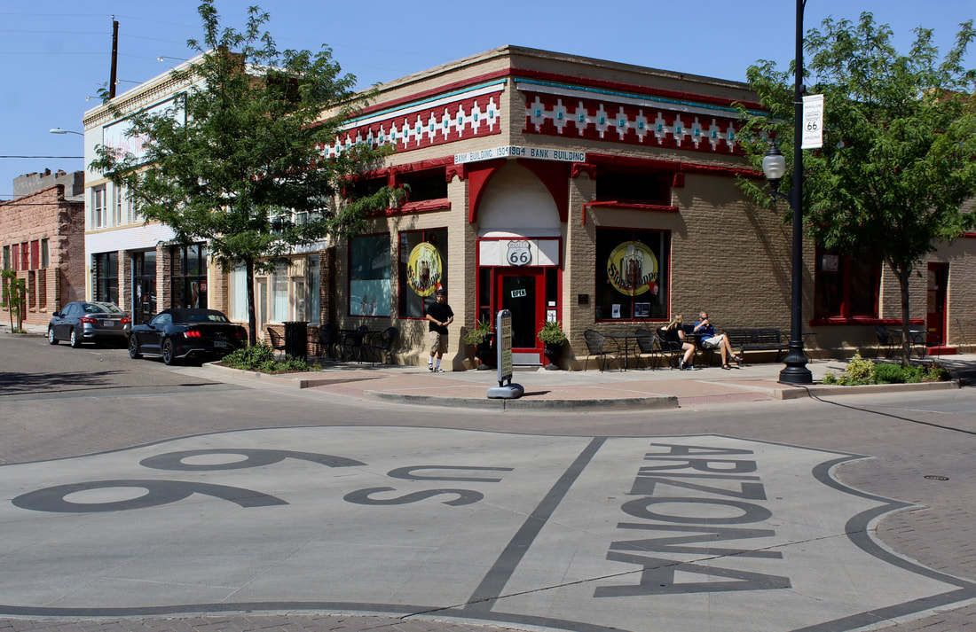
The Standing on the Corner Park, to the right of this shot, is a busy spot on Route 66 or Second Street and Kinsley Avenue.
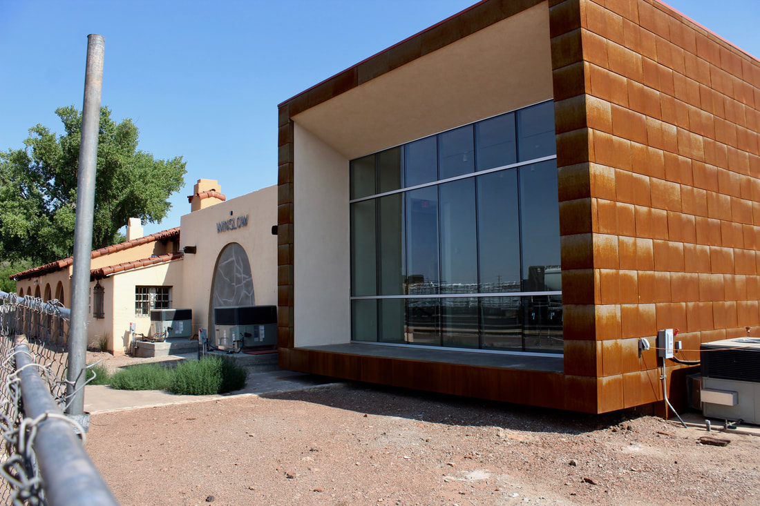
The Affeldt Mion Museum opened in spring 2019 adjacent to La Posada Hotel in the former Winslow train depot with a new attached gallery.
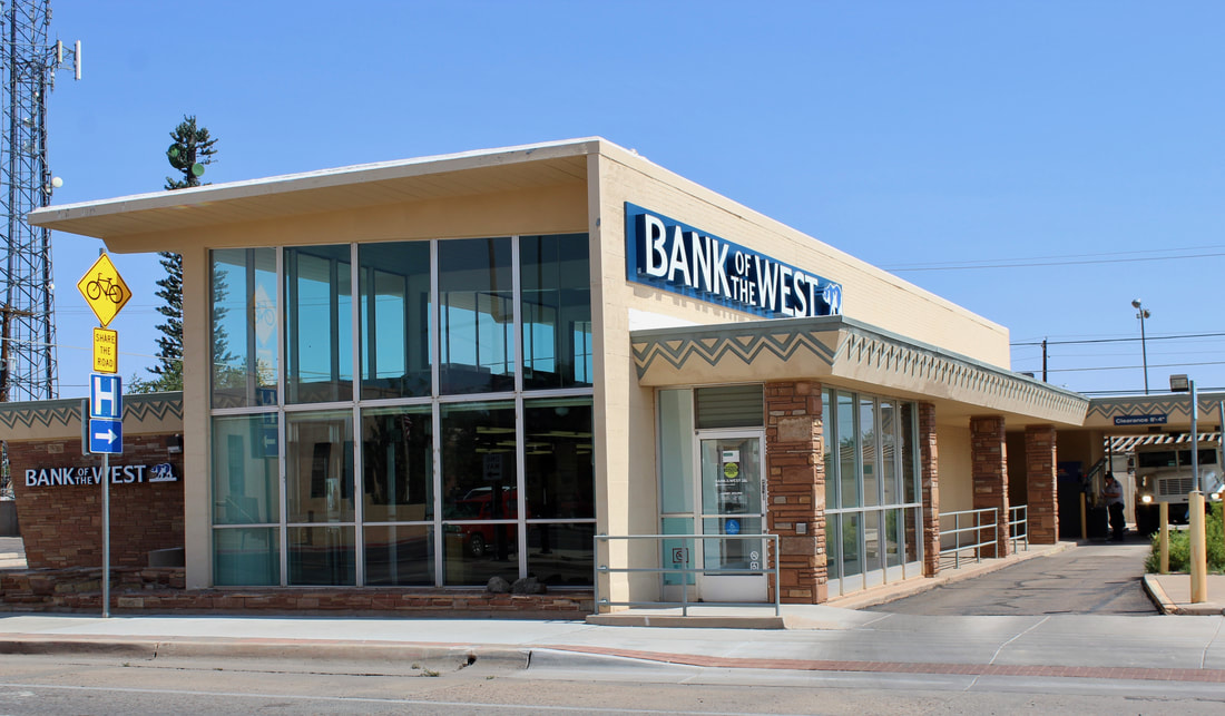
A midcentury modern bank, which opened in the early 1950s on the westbound side of Route 66, stands out among
older historic buildings.
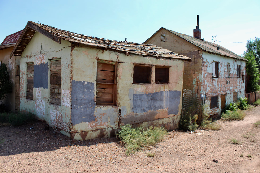
A ruin of a rock and souvenir shop is along eastbound Route 66 at Ruby Wash in Winslow.
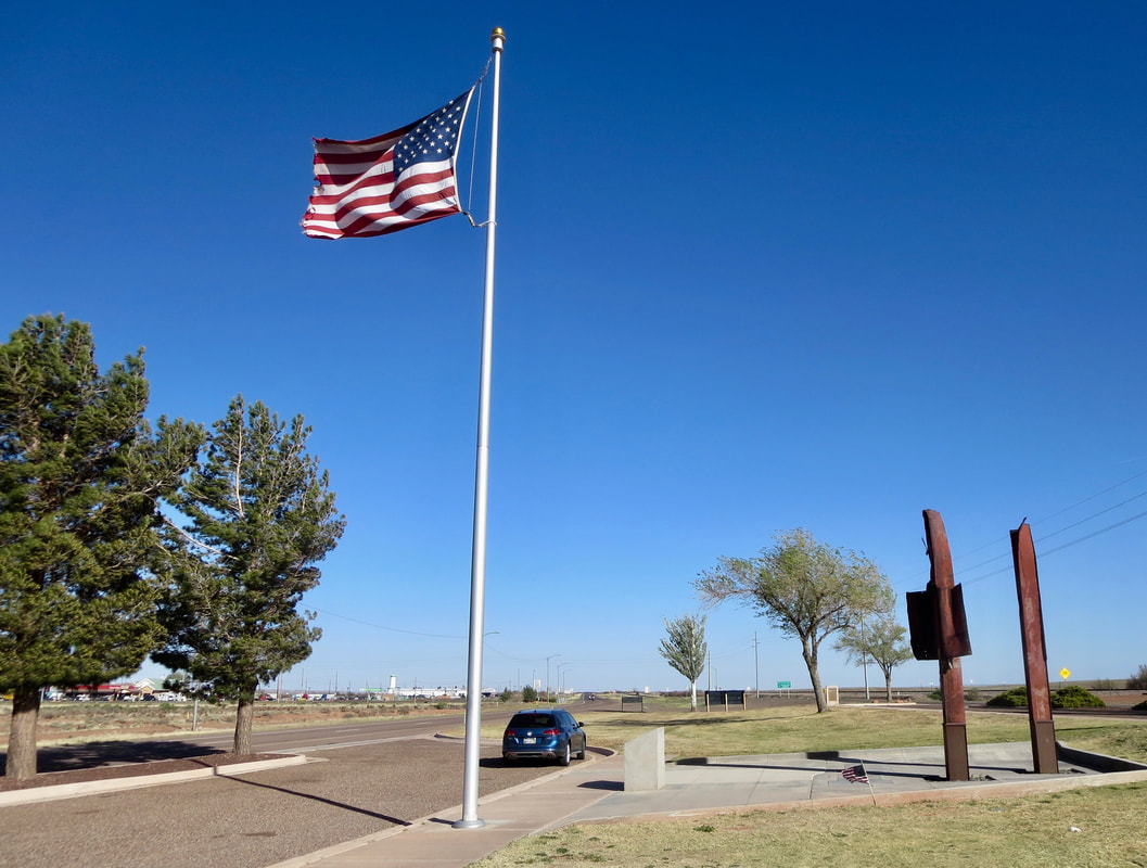
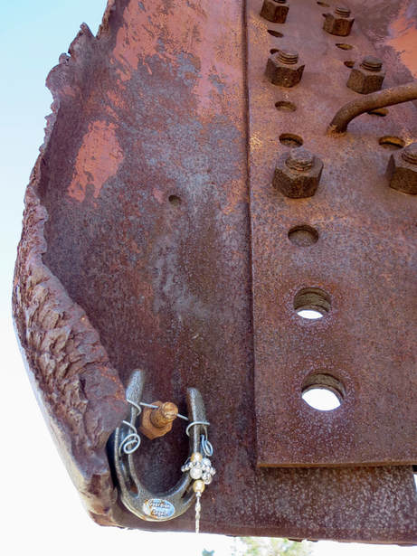
Winslow's 9-11 memorial is at a rest stop on the eastern edge of town. It includes damaged beams from the World Trade Center.
|
|