ON THE ROAD ARIZONA
  • Home
    • About
    • Contact
  • Best of Arizona
    • Historic Maps
    • Best Arizona Events
    • Best Cycling Route
    • Best Scenic Drives
    • Best Saloons
    • Best Cactus League Ballparks
    • Best Vintage Neon
    • Best Bridges
    • Best Place Names
    • Best Historic Hotels
    • Best Road Songs
    • Best Historic Lodges
    • Arizona state symbols
    • Best Ways to Stay Safe
    • Best Metro Phoenix Resorts
  • Route 66
    • Ash Fork
    • Bellemont
    • Flagstaff Route 66
    • Hackberry
    • Holbrook Route 66
    • Joseph City
    • Kingman Route 66
    • Lupton
    • Oatman
    • Peach Springs
    • Seligman
    • Truxton
    • Twin Arrows
    • Two Guns
    • Williams
    • Winslow Route 66
  • Towns (A-F)
    • Ajo
    • Bisbee
    • Camp Verde
    • Cave Creek
    • Clarkdale
    • Clifton
    • Cottonwood
    • Douglas
    • Flagstaff
    • Florence
  • Towns (G-P)
    • Globe
    • Holbrook
    • Jerome
    • Kingman
    • Lake Havasu City
    • Mesa
    • Miami
    • Page
    • Payson
    • Prescott
  • Towns Q-Z
    • Salome
    • Scottsdale
    • Sedona
    • Superior
    • Tombstone
    • Tucson
    • Wickenburg
    • Willcox
    • Winslow
    • Yuma
  • Natl Parks
    • Canyon de Chelly
    • Chiricahua NM
    • Grand Canyon North Rim
    • Grand Canyon South Rim
    • Granite Mtn. Hotshots Memorial
    • Hubbell Trading Post
    • Jerome State Historic Park
    • Montezuma Castle NM
    • Navajo National Monument
    • Organ Pipe National Monument
    • Petrified Forest NP
    • Saguaro NP
    • San Xavier del Bac Mission
    • Sunset Crater Volcano NM
    • Superstitions
    • Tumacacori NHP
    • Tuzigoot NM
    • Walnut Canyon NM
    • Wupatki NM

Oatman

Gold discovered in the early 20th century fueled growth in Oatman for a few decades. The town was originally called Vivian but it was changed to Oatman in 1909 with the establishment of a post office. 

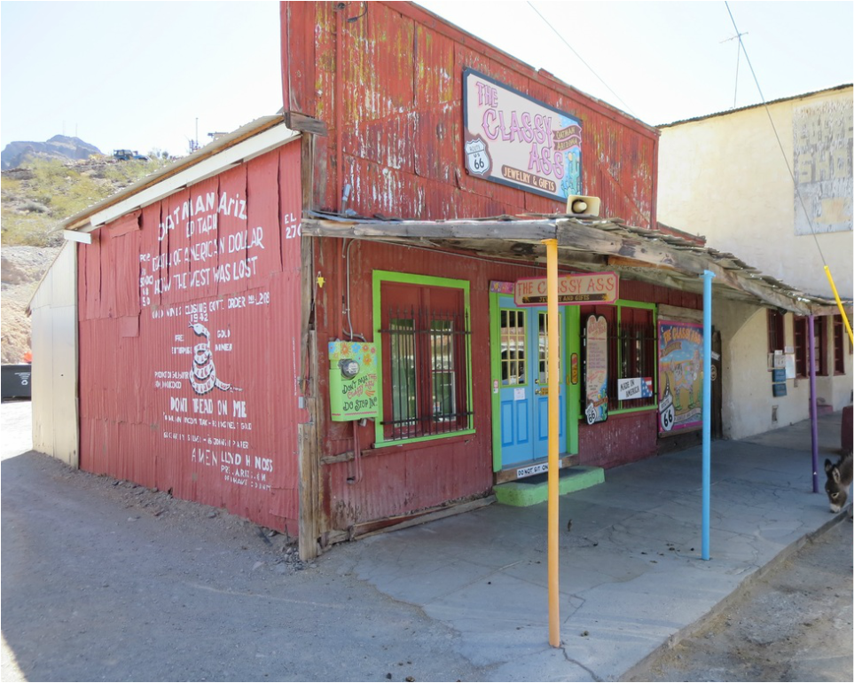
Oatman's population peaked at about 10,000 in the 1930s, some reports say. The miners moved on when the ore played out. In that exodus, ore-hauling burros  were left behind.

Those feral beasts of burden still populate Oatman as the star tourist attraction. Visitors can buy cheap food pellets to feed the burros. 

The animals also gave rise to names of local shops -- Jackass Junction and the Classy Ass. 

One key attraction on the drive to Oatman is the Cool Springs filling station, built in the mid-1920s. The volcanic rock building is
on a tortuous stretch of Route 66 that winds its way up to Oatman over Sitgreaves Pass.

Cool Springs burned down in 1966 and was rubble for more than three decades. Then Ned Leuchtner bought the ruins in 2001 and painstakingly rebuilt it as a gift shop.

Meanwhile, Route 66 was realigned in 1952 and Oatman was bypassed. Adventurous drivers and motorcyclists still make the 29-mile jaunt from Kingman to this ramshackle mining town.

​Recreational vehicles would not do well on this narrow road and vehicles over 40 feet are banned. Oatman is also accessible from
Bullhead City, a 28-mile drive paved road.    bit.ly/2wNdnwx
Picture

The 2010 U.S. Census lists Oatman's population at 135.

Founded: 1909 
Elevation: 2,710
Population: 135

Next stop eastbound is Kingman:
http://www.ontheroadarizona.com/kingmanroute66.html
Picture
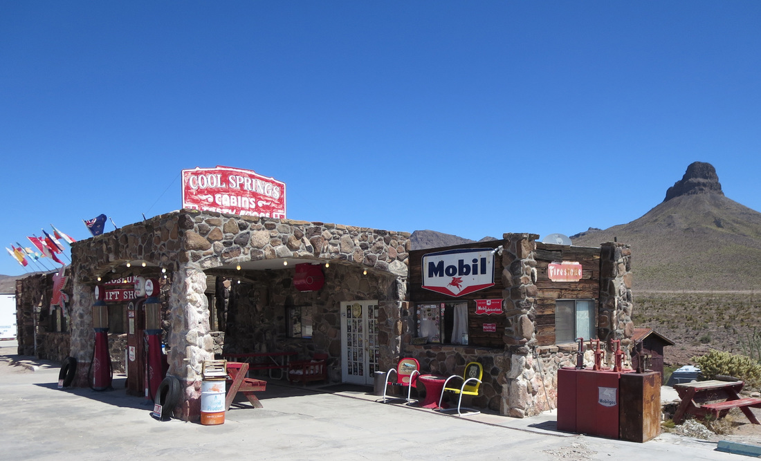
Cool Springs, with Thimble Butte in the background, is on a hilly and narrow stretch of Route 66 between Kingman and Oatman.
Picture
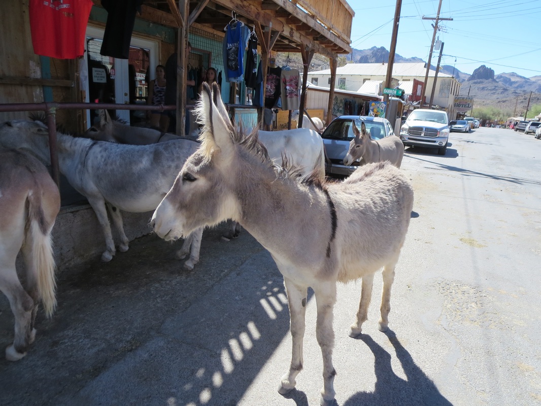
Burros on Oatman's streets are descended from animals miners left behind.
Picture
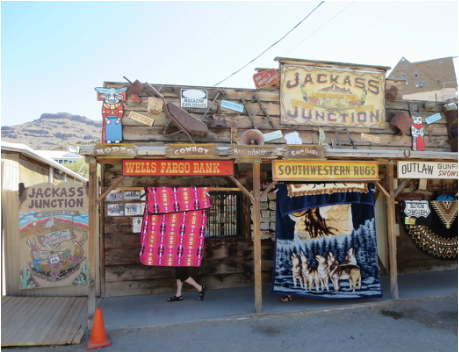
The tourist shop names play off the town's burros.
Picture
Oatman was bypassed when Route 66 was realigned in 1952, eliminating a narrow highway that cut through Sitgreaves Pass at an elevation of 3,556 feet.
Picture
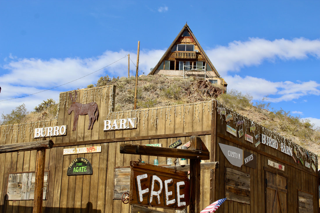
An A-frame home above Oatman's main street and the Burro Barn shop.
Picture
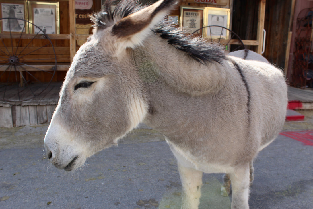
Burros are the star attraction, posing for photos and mingling with tourists.
Proudly powered by Weebly
  • Home
    • About
    • Contact
  • Best of Arizona
    • Historic Maps
    • Best Arizona Events
    • Best Cycling Route
    • Best Scenic Drives
    • Best Saloons
    • Best Cactus League Ballparks
    • Best Vintage Neon
    • Best Bridges
    • Best Place Names
    • Best Historic Hotels
    • Best Road Songs
    • Best Historic Lodges
    • Arizona state symbols
    • Best Ways to Stay Safe
    • Best Metro Phoenix Resorts
  • Route 66
    • Ash Fork
    • Bellemont
    • Flagstaff Route 66
    • Hackberry
    • Holbrook Route 66
    • Joseph City
    • Kingman Route 66
    • Lupton
    • Oatman
    • Peach Springs
    • Seligman
    • Truxton
    • Twin Arrows
    • Two Guns
    • Williams
    • Winslow Route 66
  • Towns (A-F)
    • Ajo
    • Bisbee
    • Camp Verde
    • Cave Creek
    • Clarkdale
    • Clifton
    • Cottonwood
    • Douglas
    • Flagstaff
    • Florence
  • Towns (G-P)
    • Globe
    • Holbrook
    • Jerome
    • Kingman
    • Lake Havasu City
    • Mesa
    • Miami
    • Page
    • Payson
    • Prescott
  • Towns Q-Z
    • Salome
    • Scottsdale
    • Sedona
    • Superior
    • Tombstone
    • Tucson
    • Wickenburg
    • Willcox
    • Winslow
    • Yuma
  • Natl Parks
    • Canyon de Chelly
    • Chiricahua NM
    • Grand Canyon North Rim
    • Grand Canyon South Rim
    • Granite Mtn. Hotshots Memorial
    • Hubbell Trading Post
    • Jerome State Historic Park
    • Montezuma Castle NM
    • Navajo National Monument
    • Organ Pipe National Monument
    • Petrified Forest NP
    • Saguaro NP
    • San Xavier del Bac Mission
    • Sunset Crater Volcano NM
    • Superstitions
    • Tumacacori NHP
    • Tuzigoot NM
    • Walnut Canyon NM
    • Wupatki NM