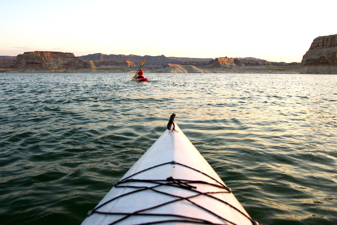
Kayakers can paddle into narrow canyons on Lake Powell in the Glen Canyon National Recreation Area. (Photo by Austin Corbett)
Page
|
Page on the edge of Lake Powell and Arizona shines as a base camp for adventure in the nearby canyons and reservoir behind Glen Canyon Dam.
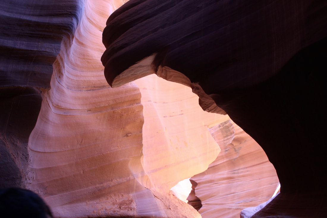
The beauty of Glen Canyon, still evident above the lake, is a mere hint of how special it was. Photographs of Glen Canyon, and those who knew it, lament the loss brought on by a cement dam across the Colorado River more than a half century ago. Page owes it existence to the dam. The community atop Manson Mesa, initially called Government Camp, was established for construction workers in 1957. It was incorporated in 1975, a dozen years after the dam was completed. Now, scenic attractions and five marinas in the Glen Canyon National Recreation Area attract visitors from all over the world. Tour buses are a common sight. Ski boats, jet skis and 75-foot houseboats, some with helicopter decks, travel the lake. Tourists flock to slot canyons — Lower and Upper Antelope canyons — on the Navajo Reservation outside of Page. The canyons, sculpted by wind and rushing water, are magical with subterranean grottos and slivers of sunlight filtering in. Avoid busy weekends to better enjoy the canyons without lines of people crowding the narrow passageways. Crowds have become an issue at Horseshoe Bend on the Colorado River 10 miles south of Page on US 89 between milepost 544-545. New parking lots and visitor facilities are in place for the scenic overlook. Page charges a $10 fee for cars, trucks and RVs. The site is open from sunrise to sunset. Travelers hike about 1.25 miles roundtrip to the Horseshoe Bend overlook. Summer temperatures often top 100 degrees. It's best to avoid this trek in hotter weather unless you go early in the day. Explore lake, wide open canyon lands Visitors can find vast stretches of canyon country around Page and open water to explore on the lake. There are quiet coves and towering cliffs. Rainbow Bridge is reached by boat or a 28-mile roundtrip hike. Tour boats cannot currently dock at Rainbow Bridge because of a two-decade drought and lower water levels. Some boat ramps on the lake are also closed. Popular hiking spots include Coyotes Buttes North — also known as the Wave — Coyotes Buttes South and Paria Canyon southwest of Page. Check with the Bureau of Land Management office (435-688-3200 or https://on.doi.gov/2rGSahe) for hiking permits at Coyotes Buttes and the Wave. House Rock Valley Road, which leads to Coyotes Buttes, also connects US 89 in Utah west of Page and US 89A northwest of Marble Canyon in Arizona. It’s a scenic, unpaved route of 29 miles in the Vermilion Cliffs National Monument that's suitable for passenger vehicles in good weather. Page is full of chain motels, independent inns, vacation rentals, restaurants, a supermarket, facilities for boat and RV repairs, and 12 houses of worship on Church Row. |
The Ranch House Grill serves a decent breakfast. The beer and pizza were good at the cavernous Grand Canyon Brewery & Distillery, which opened in spring 2022 in the city's old firehouse. We'd also like to try the nearby Dam Bar & Grille in the Dam Plaza on Navajo Drive and the Bird House chicken and beer drive-in.
The city of Page is named for John C. Page, who was a U.S. Bureau of Reclamation commissioner under FDR. Page died in 1955 before construction started on the dam in October 1956. A John C. Page Park includes a skate park, basketball and four pickleball courts. 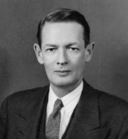
John C. Page (1887-1955) (Bureau photo)
Page was home to the Navajo Generating Station, one of the largest coal-fired power plants in the Southwest. It shut down on Nov. 18, 2019 after more than 40 years in operation. A surplus of natural gas at low prices and renewable energy options made the coal plant uneconomical to operate. It was also targeted as a major polluter in the Four Corner region.
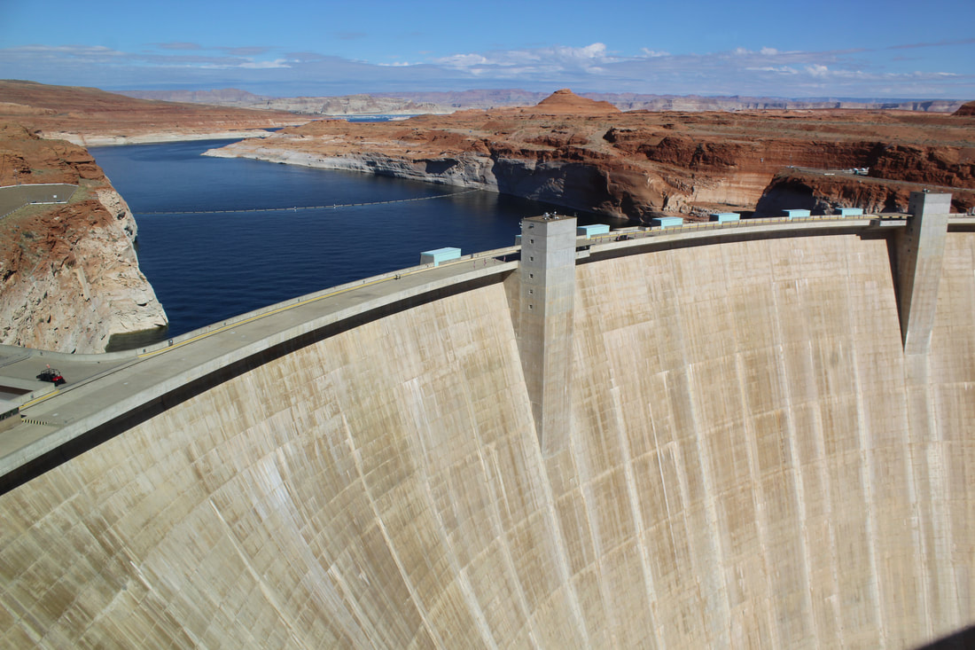
On Page's main drag, we suggest a visit to the John Wesley Powell River History Museum. It serves as the Page-Lake Powell Visitor Center. 2019 was the 150th anniversary of Powell’s epic journey down the uncharted Colorado River through Glen Canyon and Grand Canyon. See a beautiful stretch of the river on full- and half-day raft and kayak trips through lower Glen Canyon. Rafts make the 15-mile run from the base of 710-foot Glen Canyon Dam to Lees Ferry. Power-boat shuttles provided by Kayak the Colorado take kayakers upstream for paddle trips . Anglers can test their luck with world-class trout fishing at Lees Ferry. Outfitters and guides are available in Page and nearby Marble Canyon. If that’s not enough, Page is also a border town for the Navajo Reservation that covers part of four states. Explore the rez with its scattering of trading posts, Navajo National Monument and the iconic buttes of Monument Valley, both about 90 minutes away. Founded: 1957 Elevation: 4,117 feet Population: 7,516 Visit Navajo National Monument 88 miles southeast of Page: http://www.ontheroadarizona.com/navajo-national-monument.html |
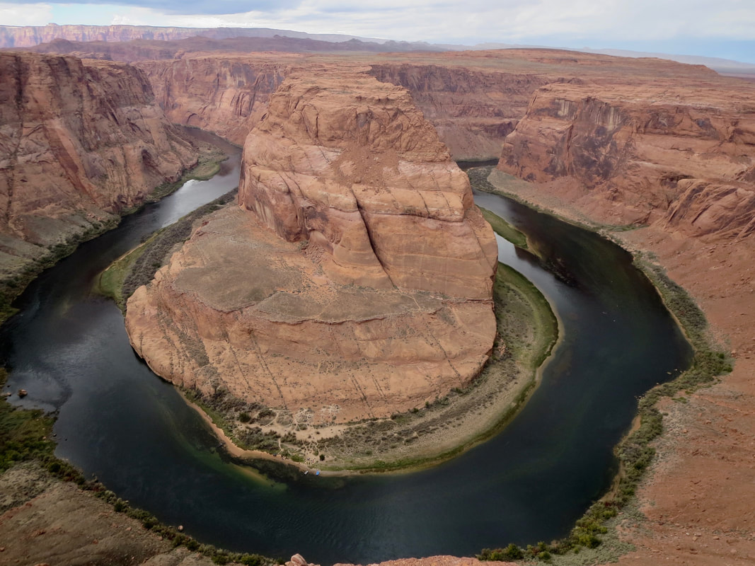
An overlook of Horseshoe Bend on the Colorado River just south of Page is one of the area's busiest attractions.
Avoid weekends to better enjoy the Antelope slot canyon without crowds of visitors.
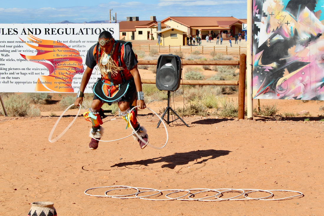
A traditional Navajo hoop dancer performs for visitors to Lower Antelope Canyon outside of Page.
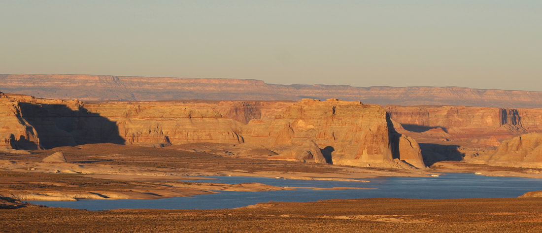
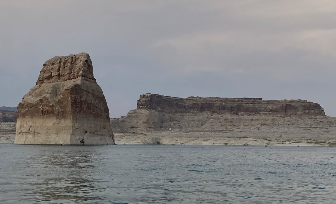
Lake Powell is a vast reservoir within the Glen Canyon National Recreation Area that's a playground for everything from kayaks to houseboats.
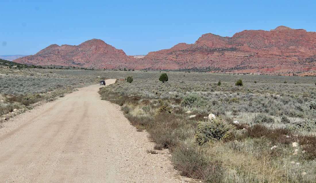
House Rock Valley Road southwest of Page links US 89A and US 89 via a scenic 29 -mile route that's suitable for passenger cars in good weather.
Page started in 1957 as a construction camp for Glen Canyon Dam.
|
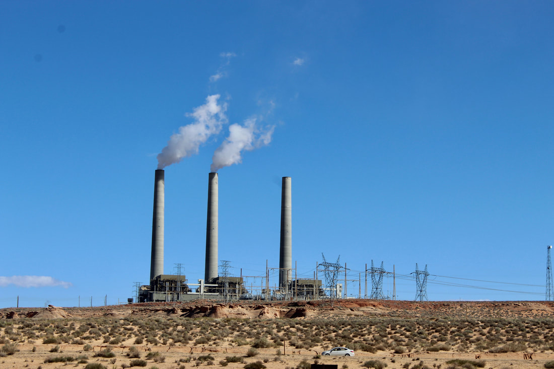
Navajo Generating Station shut down in 2019 and was razed.
|
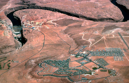
An aerial look at Page in 1963. (Bureau of Reclamation photo)
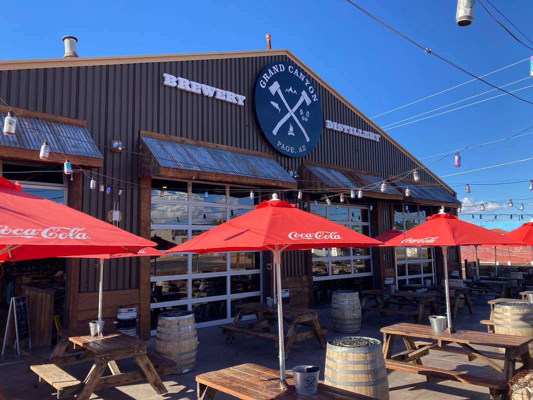
Grand Canyon Brewery opened in spring 2022 in Page's former firehouse.
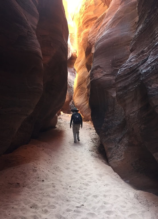
A hiker navigates a slot canyon in southern Utah west of Glen Canyon.
|
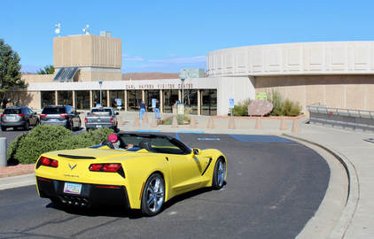
Carl Hayden Visitor Center offers Glen Canyon Dam tours.

Grand Canyon Brewery also has brew pubs in Wiliams and Flagstaff.
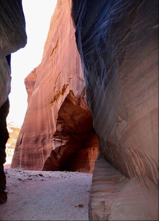
An alcove at a junction of slot canyons in southern Utah near Page.
|
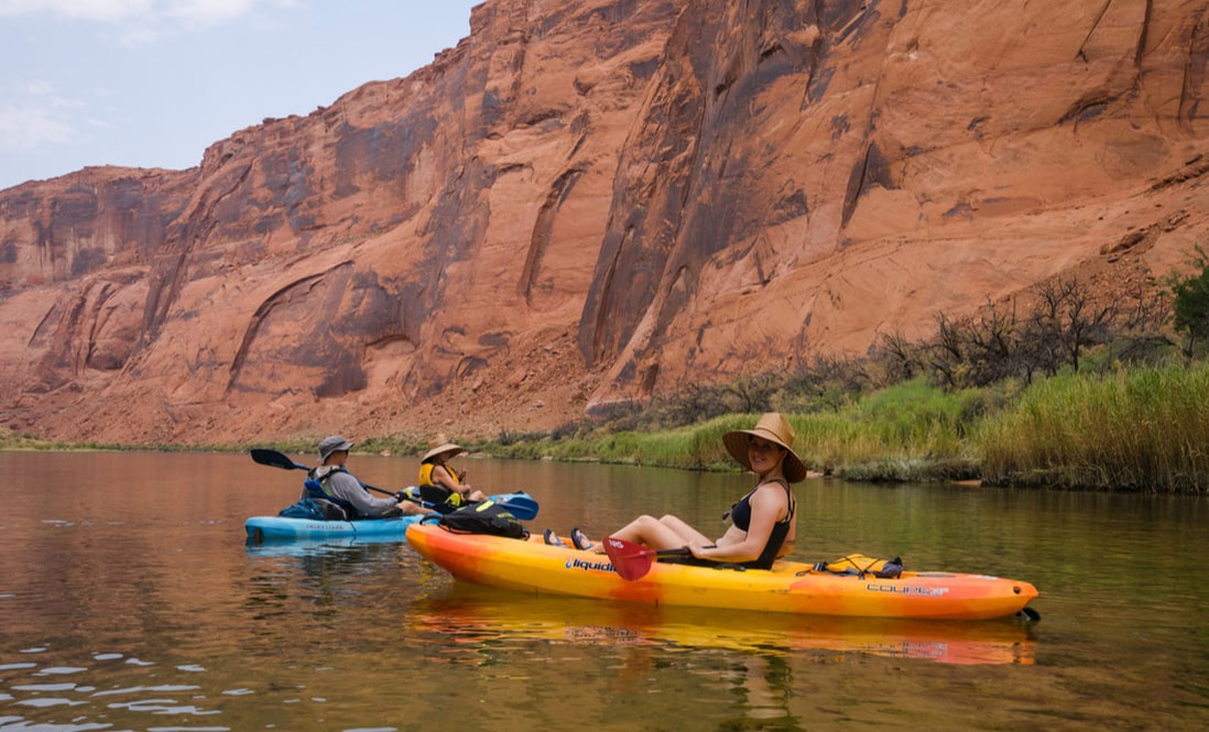
Kayakers paddling in lower Glen Canyon above Lees Ferry.
|
Lone Rock is no longer surrounded by water due to the 20-year drought.
|
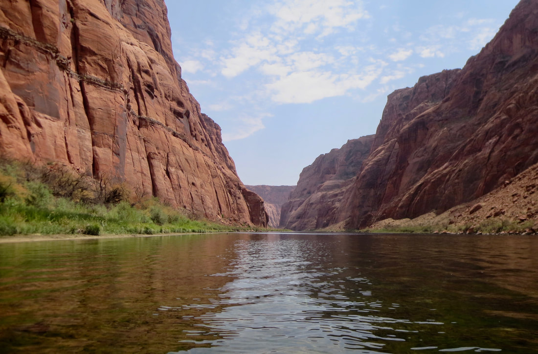
The Colorado River from Glen Canyon Dam to Lees Ferry is popular for raft and kayak trips with bighorn sheep and wild horses along the river banks.