Best Route 66 Cycling Route
|
Cycling across what remains of Route 66 from Gallup, N.M, to Oatman, Ariz., is close to 400 miles with a lot of unconnected local routes and sections where riders must travel on Interstate 40.
The best section of Route 66 to cycle across Arizona starts just west of Ash Fork and continues for about 100 miles to Kingman. Take the Crookton Road exit just past Ash Fork to ride on a lightly traveled alignment of old Route 66 for less than 25 miles. It's a narrow two-lane road with virtually no shoulder that crosses over the BNSF railroad tracks and Crookton Pass. Upon arriving in Seligman, stop at the Snow Cap drive-in for ice cream or a milkshake. Fill your water bottles for a 75-mile ride across the high desert to Kingman. This is one of the longest remaining stretches of Route 66. Historic Route 66 between Seligman and Kingman is generally a wide two-lane highway with a shoulder. It is not heavily traveled. There are few heavy trucks on this route and most travelers are locals or Route 66 roadies. It's 25 miles from Seligman to a stop at Grand Canyon Caverns and 16 miles to Peach Springs, which has a convenience store. The next stop is 23 miles distant at the quirky Hackberry General Store. The final leg to Kingman is about 30 miles. But there is a stop at Antares, east of Kingman, with an Easter Island-like sculpture at this roadside attraction. From Kingman take the Oatman Highway for 28 miles to the ghost town of Oatman, where burros wander the streets. The last 15 miles into Oatman is a narrow, serpentine road with no shoulder. This is a risky section for riders since drivers may not see cyclists until their right upon them. The final 20-mile route of old Route 66 from Oatman to Topock is lightly traveled and drivers generally will be able to spot cyclists as they approach. The best time of year to cycle on Route 66 in Arizona is roughly from April to October. However, there are frequent afternoon thunderstorms that Route 66 bicyclists could encounter from late June to September. |
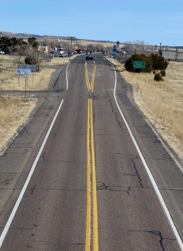
Historic Route 66 looking east on the west side of Seligman.
Snowstorms occur as late as May and as early as September.
The prevailing winds are from west to east and this high altitude route is frequently windy. The elevation ranges from 6,900 feet in Flagstaff to a mile high in Seligman, 3,333 feet in Kingman and 600 feet in Topock at the Colorado River. Best to take care of on cycling equipment needs in Flagstaff or other larger towns where bike shops exist. We also recommend cycling on the West Rim of the Grand Canyon to Hermit's Rest. It's about 15 miles roundtrip. The road is closed except for shuttle buses and a few Hermit Trail overnight hikers with permits. The views along the rim are spectacular. There are restrooms, water and limited snack food at Hermit's Rest |
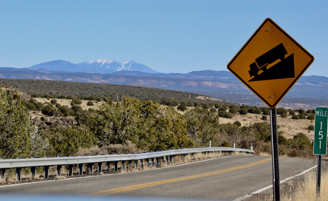
Historic Route 66 over Crookton Pass west of Ash Fork with the San Francisco Peaks in the distance.
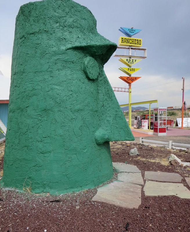
Antares Point roadside attraction is the last stop on Route 66 before cyclists reach Kingman in western Arizona.
|
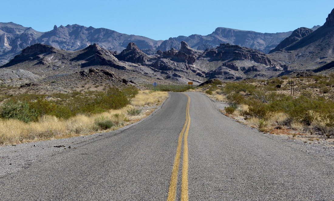
The Oatman-Topock Highway is a lightly traveled old Route 66 alignment.
|