ON THE ROAD ARIZONA
  • Home
    • About
    • Contact
  • Best of Arizona
    • Historic Maps
    • Best Arizona Events
    • Best Cycling Route
    • Best Scenic Drives
    • Best Saloons
    • Best Cactus League Ballparks
    • Best Vintage Neon
    • Best Bridges
    • Best Place Names
    • Best Historic Hotels
    • Best Road Songs
    • Best Historic Lodges
    • Arizona state symbols
    • Best Ways to Stay Safe
    • Best Metro Phoenix Resorts
  • Route 66
    • Ash Fork
    • Bellemont
    • Flagstaff Route 66
    • Hackberry
    • Holbrook Route 66
    • Joseph City
    • Kingman Route 66
    • Lupton
    • Oatman
    • Peach Springs
    • Seligman
    • Truxton
    • Twin Arrows
    • Two Guns
    • Williams
    • Winslow Route 66
  • Towns (A-F)
    • Ajo
    • Bisbee
    • Camp Verde
    • Cave Creek
    • Clarkdale
    • Clifton
    • Cottonwood
    • Douglas
    • Flagstaff
    • Florence
  • Towns (G-P)
    • Globe
    • Holbrook
    • Jerome
    • Kingman
    • Lake Havasu City
    • Mesa
    • Miami
    • Page
    • Payson
    • Prescott
  • Towns Q-Z
    • Salome
    • Scottsdale
    • Sedona
    • Superior
    • Tombstone
    • Tucson
    • Wickenburg
    • Willcox
    • Winslow
    • Yuma
  • Natl Parks
    • Canyon de Chelly
    • Chiricahua NM
    • Grand Canyon North Rim
    • Grand Canyon South Rim
    • Granite Mtn. Hotshots Memorial
    • Hubbell Trading Post
    • Jerome State Historic Park
    • Montezuma Castle NM
    • Navajo National Monument
    • Organ Pipe National Monument
    • Petrified Forest NP
    • Saguaro NP
    • San Xavier del Bac Mission
    • Sunset Crater Volcano NM
    • Superstitions
    • Tumacacori NHP
    • Tuzigoot NM
    • Walnut Canyon NM
    • Wupatki NM

Organ Pipe National Monument 

Picture
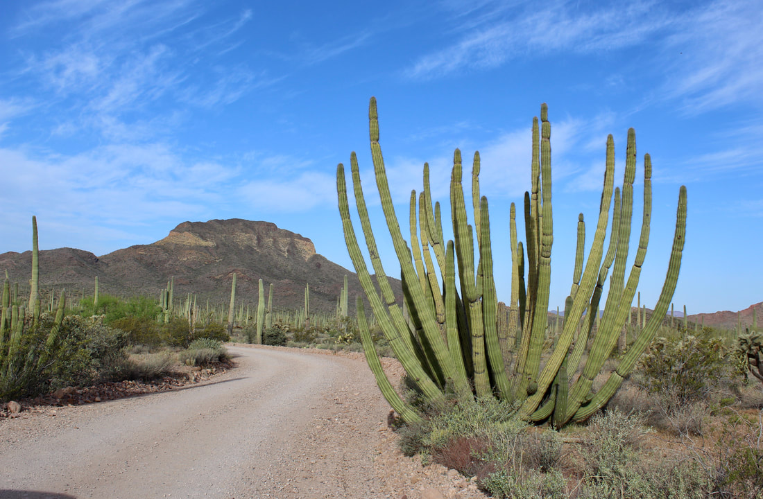
Ajo Mountain Drive is a 21-mile one-way loop with views of Arch Canyon, Mount Ajo (4,808 feet) and Estes Canyon. It's unpaved but OK for most vehicles.
Organ Pipe National Monument hugs the border with Mexico south of Ajo, a former copper mining town still recovering from the mine shutdown in 1985. 

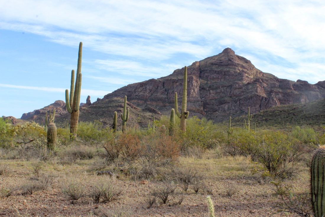
The park is about 145 miles from both Phoenix and Tucson and the trip takes close to 2.5 hours. 


State Route 85 cuts the park in half with the main developed campground -- Twin Peaks -- just west of the highway near the Kris Eggle Visitor Center.

Open year-round, the campground has 174 sites for RVs and 34 for tents. Twin Peaks has water, restrooms, showers, grills, tables and an RV dump station. Campsite reservations are required for January through March. 


The undeveloped Alamo Canyon Campground, east of the highway, is for tents, vans and truck campers. It is available on a first-come, first-served basis. 

Organ Pipe features two scenic drives. The Ajo Mountain Drive is a 21-mile one-way loop on a largely unpaved road but is passable in dry weather in a car.

The drive takes about two to three hours to traverse the lush Sonoran Desert terrain teeming with organ pipe, ocotillo, saguaro, cholla, prickly pear and other cacti. 


The Puerto Blanco Drive covers 41 miles in three to four hours, with part of it running along the border. 

Visitors are likely to see Border Patrol agents in their SUVs watching for undocumented immigrants and smugglers.
Picture
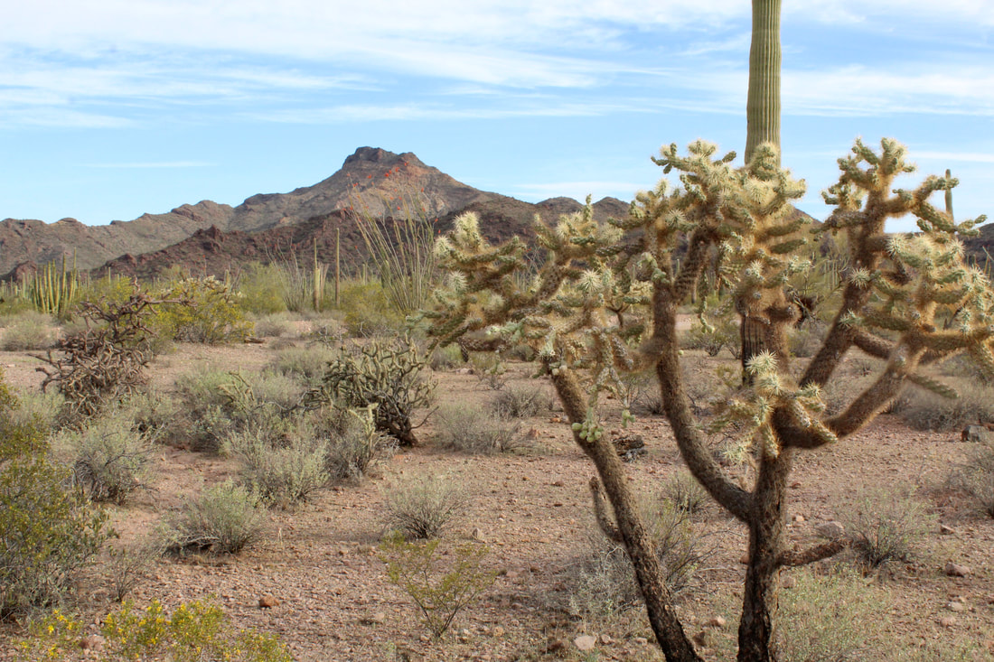
Cacti in the park includes cholla, saguaros and organ pipe.
The National Park Service gives this warning: "Organ Pipe Cactus National Monument is a safe place to visit. However, illegal border crossings and activities, including drug smuggling, occur daily. It is unlikely that you will encounter any illegal border activity, but you should be aware that such a situation is possible."

During hot weather, visitors should be cautious about sun exposure and having adequate water to stay hydrated. Wear a hat and apply sunscreen. Average daily high temperatures are 85 degrees Fahrenheit or higher from April to October.  (See chart below)

A popular hike is 4.4-mile roundtrip trek through rolling terrain to the former Victoria silver mine. 


​Established: 1937
Elevation: 1,670 feet at the Visitor Center
Annual Visitation: 190,848
Picture
Time your visit from late October to April to avoid triple-digit heat.
Picture
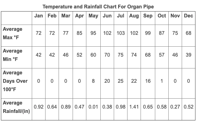
Source: National Park Service
Picture
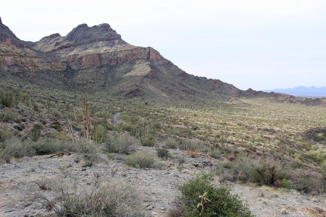
Parts of Ajo Mountain Drive are paved through arroyo crossings and on steeper sections of the road.
Picture
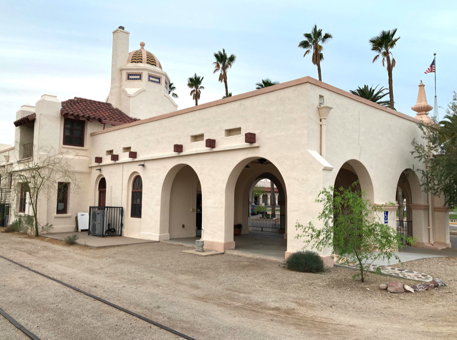
In nearby Ajo, the former depot for the Tucson, Cornelia & Gila Bend Railroad sits on the edge of the town plaza. The line shut down in 1985.
Proudly powered by Weebly
  • Home
    • About
    • Contact
  • Best of Arizona
    • Historic Maps
    • Best Arizona Events
    • Best Cycling Route
    • Best Scenic Drives
    • Best Saloons
    • Best Cactus League Ballparks
    • Best Vintage Neon
    • Best Bridges
    • Best Place Names
    • Best Historic Hotels
    • Best Road Songs
    • Best Historic Lodges
    • Arizona state symbols
    • Best Ways to Stay Safe
    • Best Metro Phoenix Resorts
  • Route 66
    • Ash Fork
    • Bellemont
    • Flagstaff Route 66
    • Hackberry
    • Holbrook Route 66
    • Joseph City
    • Kingman Route 66
    • Lupton
    • Oatman
    • Peach Springs
    • Seligman
    • Truxton
    • Twin Arrows
    • Two Guns
    • Williams
    • Winslow Route 66
  • Towns (A-F)
    • Ajo
    • Bisbee
    • Camp Verde
    • Cave Creek
    • Clarkdale
    • Clifton
    • Cottonwood
    • Douglas
    • Flagstaff
    • Florence
  • Towns (G-P)
    • Globe
    • Holbrook
    • Jerome
    • Kingman
    • Lake Havasu City
    • Mesa
    • Miami
    • Page
    • Payson
    • Prescott
  • Towns Q-Z
    • Salome
    • Scottsdale
    • Sedona
    • Superior
    • Tombstone
    • Tucson
    • Wickenburg
    • Willcox
    • Winslow
    • Yuma
  • Natl Parks
    • Canyon de Chelly
    • Chiricahua NM
    • Grand Canyon North Rim
    • Grand Canyon South Rim
    • Granite Mtn. Hotshots Memorial
    • Hubbell Trading Post
    • Jerome State Historic Park
    • Montezuma Castle NM
    • Navajo National Monument
    • Organ Pipe National Monument
    • Petrified Forest NP
    • Saguaro NP
    • San Xavier del Bac Mission
    • Sunset Crater Volcano NM
    • Superstitions
    • Tumacacori NHP
    • Tuzigoot NM
    • Walnut Canyon NM
    • Wupatki NM