ON THE ROAD ARIZONA
  • Home
    • About
    • Contact
  • Best of Arizona
    • Historic Maps
    • Best Arizona Events
    • Best Cycling Route
    • Best Scenic Drives
    • Best Saloons
    • Best Cactus League Ballparks
    • Best Vintage Neon
    • Best Bridges
    • Best Place Names
    • Best Historic Hotels
    • Best Road Songs
    • Best Historic Lodges
    • Arizona state symbols
    • Best Ways to Stay Safe
    • Best Metro Phoenix Resorts
  • Route 66
    • Ash Fork
    • Bellemont
    • Flagstaff Route 66
    • Hackberry
    • Holbrook Route 66
    • Joseph City
    • Kingman Route 66
    • Lupton
    • Oatman
    • Peach Springs
    • Seligman
    • Truxton
    • Twin Arrows
    • Two Guns
    • Williams
    • Winslow Route 66
  • Towns (A-F)
    • Ajo
    • Bisbee
    • Camp Verde
    • Cave Creek
    • Clarkdale
    • Clifton
    • Cottonwood
    • Douglas
    • Flagstaff
    • Florence
  • Towns (G-P)
    • Globe
    • Holbrook
    • Jerome
    • Kingman
    • Lake Havasu City
    • Mesa
    • Miami
    • Page
    • Payson
    • Prescott
  • Towns Q-Z
    • Salome
    • Scottsdale
    • Sedona
    • Superior
    • Tombstone
    • Tucson
    • Wickenburg
    • Willcox
    • Winslow
    • Yuma
  • Natl Parks
    • Canyon de Chelly
    • Chiricahua NM
    • Grand Canyon North Rim
    • Grand Canyon South Rim
    • Granite Mtn. Hotshots Memorial
    • Hubbell Trading Post
    • Jerome State Historic Park
    • Montezuma Castle NM
    • Navajo National Monument
    • Organ Pipe National Monument
    • Petrified Forest NP
    • Saguaro NP
    • San Xavier del Bac Mission
    • Sunset Crater Volcano NM
    • Superstitions
    • Tumacacori NHP
    • Tuzigoot NM
    • Walnut Canyon NM
    • Wupatki NM
Picture
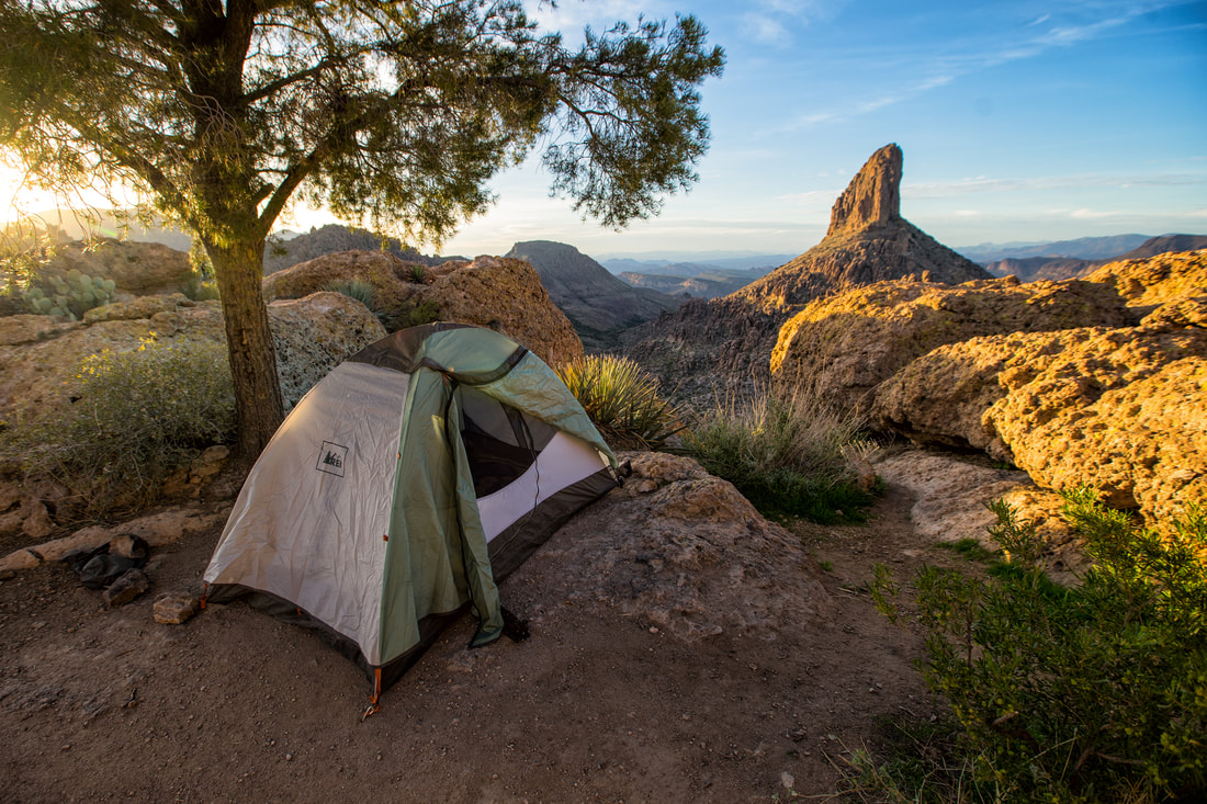
A campsite with a view of Weaver's Needle. (Photo by Austin Corbett)

Superstitions

Imagine a desert and moutain wilderness a mere hour drive from the sprawling Phoenix tangle of freeways, walled subdivisions and 3 million people. Imagine the Superstitions,  a refuge for tens of thousands of those urban residents to get away, find solitude and enjoy the beauty of the Sonoran desert. 

The urban escape of the 160,000-acre Superstition Wildnerness Area is certainly well-loved.  Many parts of it are well-traveled on weekends, but there are lots of trails and backcountry destinations for daytrippers and overnight hikers. You can get away and see few fellow hikers and a fair amount of wildlife.

The Peralta Trail is a popular introduction to the Supes, as they are known. The trailhead can be reached by traveling 8 miles east of Apache Junction on U.S. 60. Turn left past milepost 204 northbound onto Peralta Road.  It is another 7.4 miles, all but one mile unpaved, to reach a trailhed parking lot. Passenger cars are 
suitable for Peralta Road. The Peralta, Bluff Springs and Dutchman trails take off from this location.
The Tonto National Forest, which manages the Superstition Wilderness Area, lists 46 trails and 170 miles of trail. 

Lost Dutchman State Park north of Apache Junction on State Route 88 is a more developed option for a Supes visit. There are 134 campsites that go for $15 to $30 per night, with  sites available through advanced reservations. The park also offers  programs for bird-watching, stargazing and guided moonlight hikes. 


The Lost Dutchman name refers to Jacob Waltz, actually a German immigrant, who prospected in the Superstitions.  According to the lore, Waltz disclosed the existence of a rich vein of gold on his deathbed in 1891. Treasure seekers have been hunting for it -- in vain -- every since. 

Mining town of Superior is just east of the Superstitions:
http://www.ontheroadarizona.com/superior.html
Picture
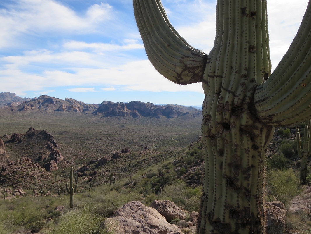
A towering saguaro is front and center in this view from Bluff Springs Trail in the 160,000-acre Superstition Wilderness Area.
Picture
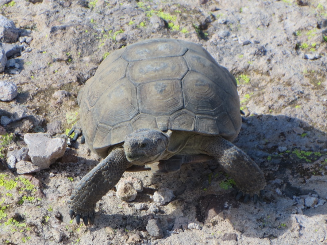
A desert tortoise blends in with the rock.
Picture
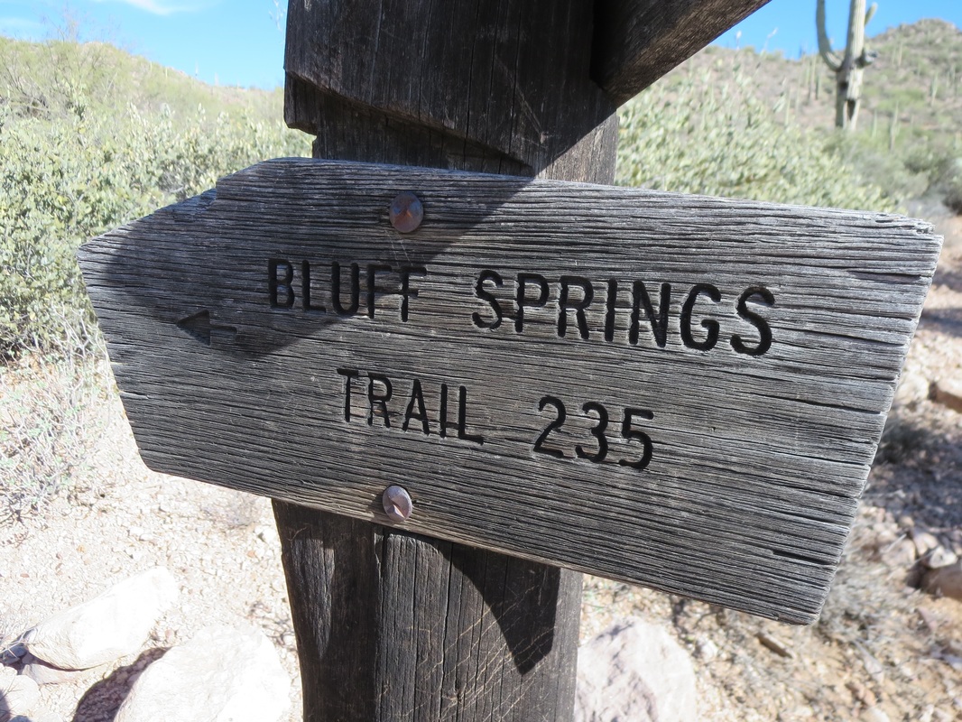
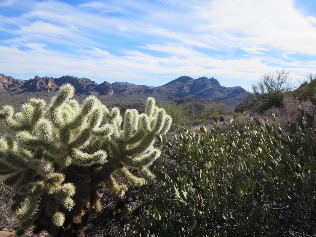
Hikers can explore 170 miles of trails on 46 different routes.
Picture
Picture
Picture
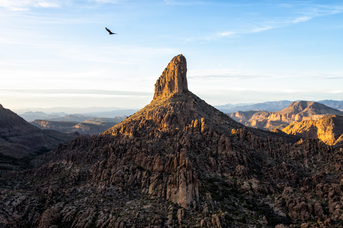
Weaver's Needle tops out at 4,555 feet in the 160,200-acre Superstition Wilderness Area. (Photo by Austin Corbett)
Proudly powered by Weebly
  • Home
    • About
    • Contact
  • Best of Arizona
    • Historic Maps
    • Best Arizona Events
    • Best Cycling Route
    • Best Scenic Drives
    • Best Saloons
    • Best Cactus League Ballparks
    • Best Vintage Neon
    • Best Bridges
    • Best Place Names
    • Best Historic Hotels
    • Best Road Songs
    • Best Historic Lodges
    • Arizona state symbols
    • Best Ways to Stay Safe
    • Best Metro Phoenix Resorts
  • Route 66
    • Ash Fork
    • Bellemont
    • Flagstaff Route 66
    • Hackberry
    • Holbrook Route 66
    • Joseph City
    • Kingman Route 66
    • Lupton
    • Oatman
    • Peach Springs
    • Seligman
    • Truxton
    • Twin Arrows
    • Two Guns
    • Williams
    • Winslow Route 66
  • Towns (A-F)
    • Ajo
    • Bisbee
    • Camp Verde
    • Cave Creek
    • Clarkdale
    • Clifton
    • Cottonwood
    • Douglas
    • Flagstaff
    • Florence
  • Towns (G-P)
    • Globe
    • Holbrook
    • Jerome
    • Kingman
    • Lake Havasu City
    • Mesa
    • Miami
    • Page
    • Payson
    • Prescott
  • Towns Q-Z
    • Salome
    • Scottsdale
    • Sedona
    • Superior
    • Tombstone
    • Tucson
    • Wickenburg
    • Willcox
    • Winslow
    • Yuma
  • Natl Parks
    • Canyon de Chelly
    • Chiricahua NM
    • Grand Canyon North Rim
    • Grand Canyon South Rim
    • Granite Mtn. Hotshots Memorial
    • Hubbell Trading Post
    • Jerome State Historic Park
    • Montezuma Castle NM
    • Navajo National Monument
    • Organ Pipe National Monument
    • Petrified Forest NP
    • Saguaro NP
    • San Xavier del Bac Mission
    • Sunset Crater Volcano NM
    • Superstitions
    • Tumacacori NHP
    • Tuzigoot NM
    • Walnut Canyon NM
    • Wupatki NM