Kingman Route 66
|
Route 66 in Kingman was brightly lit with all its garish neon for travelers along Route 66. I recall the town looking so big and bright after the long dark drive from Flagstaff through Williams, Ash Fork and Seligman on the two-lane highway.
It was the mid-1970s. We were in a big Ford pickup bound for Las Vegas, still more than an hour away. But for those miles through Kingman the blinking motel vacancy signs, brightly lit filling stations and all-night diners signaled that this town was open for business on a Friday night. This could be the end of your long day of traveling. Kingman was a home for the night as it had been for decades and generations of travelers. First for train passengers starting in the the mid-1860s. Then on the National Old Trails Highway into the first two decades of the 20th century. But that highway hospitality on Route 66 hit a dead-end in August 1980 when the super highway of Interstate 40 skirted Kingman to the south. All that was left was a couple of interchanges that made it so easy to blast right past this town. Suddenly, thousands of motel rooms sat empty night after night. Maids went idle. Mechanics watched cars pass. Waitresses sat bored at their diners with only locals showing up to sip coffee. Motorists who did pull off in town, filled up their up their fuel tanks and jumped right back on I-40 to make time across Arizona. But Kingman persisted. With its sister towns down the line to the east, Kingman was on what would be one of the longest remaining stretches of Route 66 between Chicago and Los Angeles. It was still a pretty good run on the old Mother Road of 75 miles from Seligman into Kingman. Heritage travelers would eventually show up starting in the 1990s, searching for the old highway. Looking for the old motels, diners, neon and roadside attractions on Route 66. Looking for America’s midcentury past, the post-war golden decades of cheap travel and adventures across a nation still optimistic about its unbridled future. Kingman had a lot to lose. So much of the town’s economy was driven by motor tourism. Many tourist businesses failed. Buildings were reclaimed for other uses or torn down. Motels turned to monthly rentals. New chain motels opened on I-40 interchanges, adding to the misery of the struggling local inns, some of them dating to before World War II. |
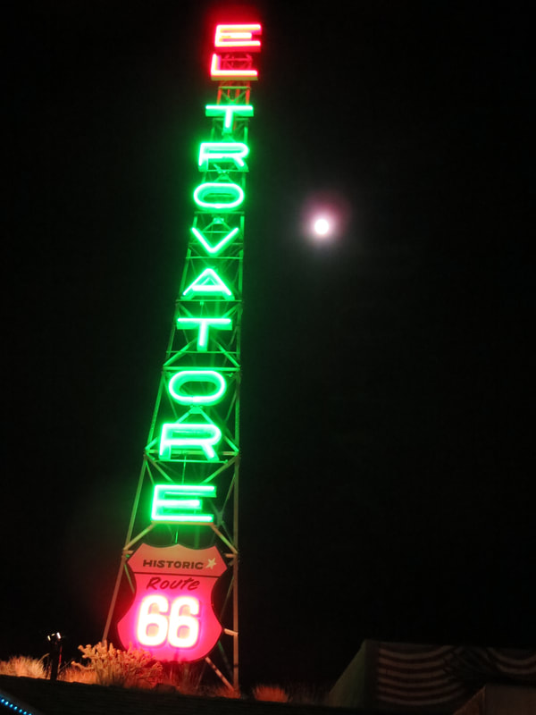
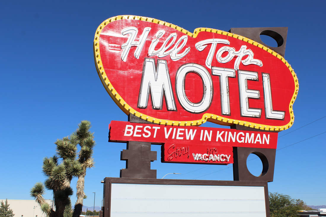
A towering neon sign beckons to travelers at a Route 66 motel.
Still, Kingman leveraged its Route 66 past and historic roots into a recognizable tourism asset. The Mohave Museum tells many local stories of mining, railroads, aviation, highway travel and Kingman’s favorite son — character actor Andy Devine.
The main street of town is named for him. The Beale Hotel that Devine’s family operated is a town landmark, although it’s closed and in need of a major restoration. Kingman also boasts the Arizona Route 66 Museum in a former powerhouse. Kingman locals also preserved the water towers along the railroad tracks and painted them with Route 66 highway shields. They’re now a town landmark near the Mission style train station. And there’s been a successful effort to restore neon signs and the town’s historic buildings. That includes the Old Trails Garage down the block from the Beale Hotel. There is so much potential for Kingman’s Route 66 legacy and some of the town’s savvy tourism promoters are heading in that direction. Go west to Oatman: http://www.ontheroadarizona.com/oatman.html |
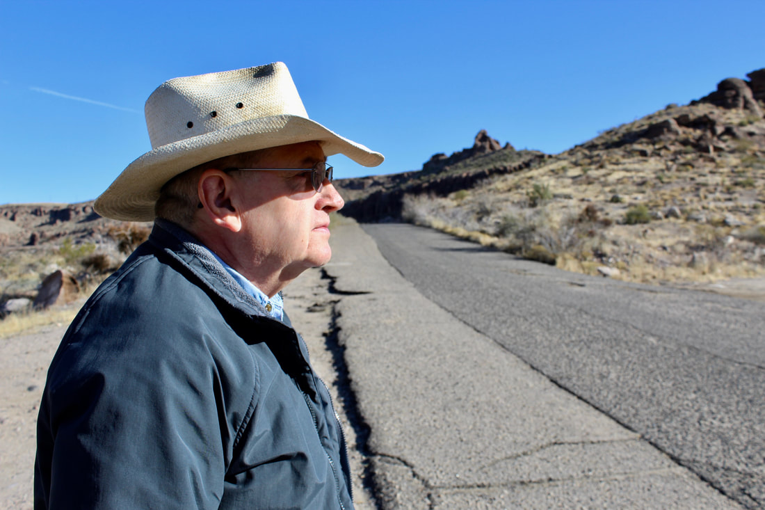
Historian Jim Hinckley on an old Route 66 alignment.
|
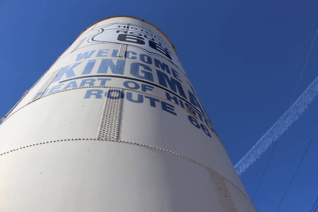
A century old water tank is a Route 66 icon for Kingman.
|
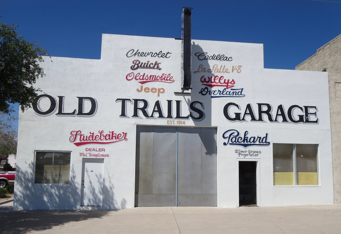
The late Elmer Graves worked at this Beale Street garage as a teenager. He later restored it to look as it did when he was growing up. Elmer died in May 2020.
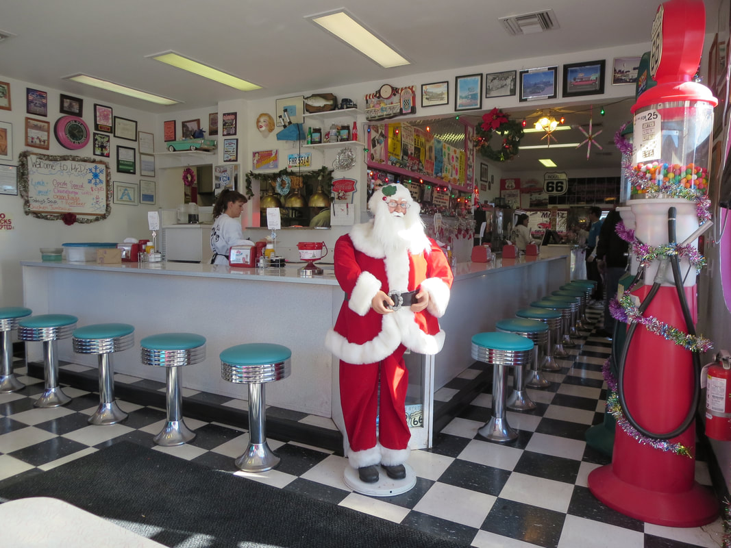 Mr. D'z Route 66 Diner has the Fifties look and a period-friendly menu.
A new owner is completing an extensive renovation of the 1954 motel.
|
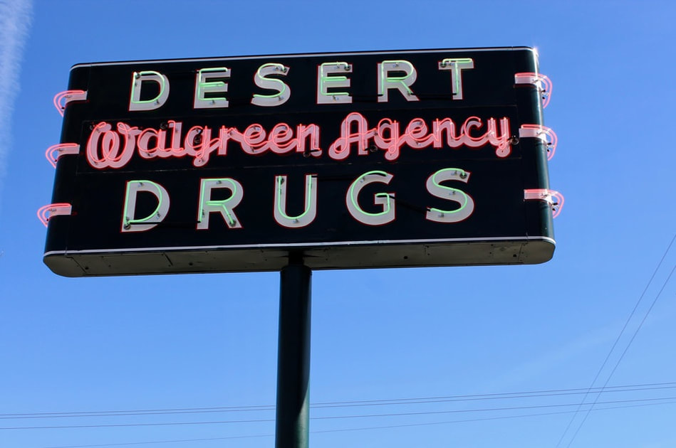
A restored Desert Drugs sign was near the Beale and Brunswick hotels.
|
The late artist Bob Waldmire painted this mural at a Kingman shop.
|
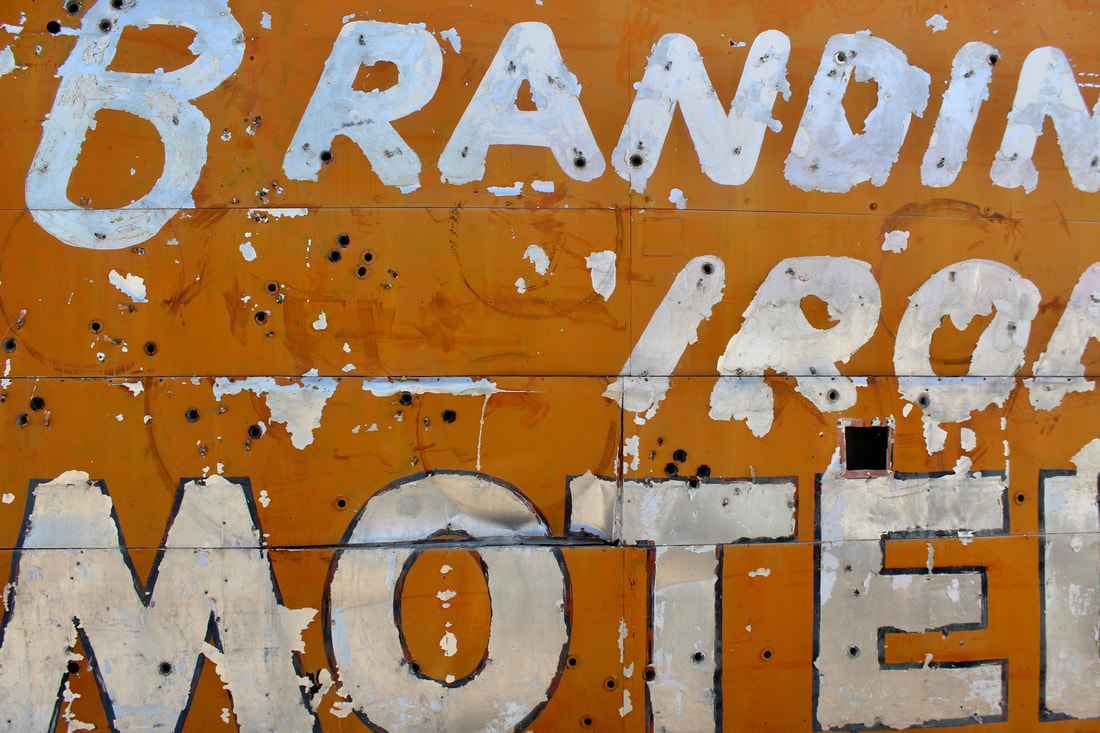
A faded Branding Iron Motel sign awaits restoration.
|
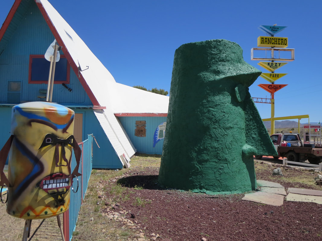
It started as Ranchero Cafe and Gas Station in 1960 east of Kingman and morphed into an unusual roadside attraction known as Giganticus Headicus.