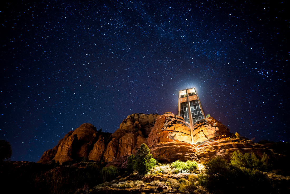
Chapel of the Holy Cross and a heavenly night sky. (Photo by Austin Corbett)
Sedona
|
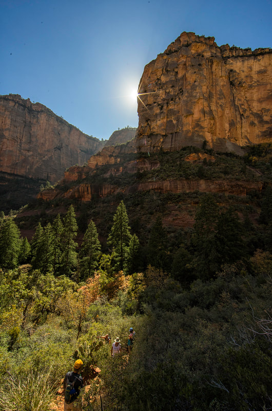
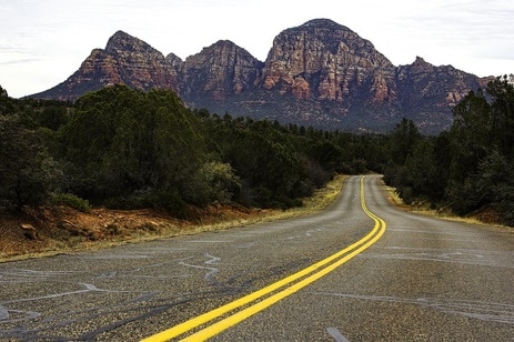
When road-trip fever hits, it seems like it's always a good time to take a weekend run to Sedona. There are good day hikes all around Sedona and in Oak Creek Canyon. Visitors should also consider touring the cliff dwellings of Honanki and Palatki, which are a short drive west of Sedona on unpaved roads suitable for passenger vehicles. The two sites are the largest cliff dwellings in the Red Rock region and were occupied from about 1150 to 1350 A.D. Red Rock State Park is a beautiful spot on Oak Creek, which you can reach from Upper Red Rock Loop at the western edge of town or Red Rock Loop Road just west of town. In either direction it's a scenic drive. In town, there are scores of shops in uptown Sedona with places catering to every whim from jeep tours to New Age mysticism. Visitors might enjoy a stroll through the courtyards and shops at Tlaquepaque, built a half century ago in a Spanish colonial style. It's on Oak Creek just south of the junction of State Routes 89A and 179. In Uptown Sedona, I suggest a visit to the Cowboy Club if you have an an interest in cowboy artists. A rancher and his wife opened a tavern where the Cowboy Club is now in 1945. It became Oak Creek Tavern a decade later and in 1965 was the spot where a handful of Western artists formed the Cowboy Artists of America. The CAA group and its artists have become hugely successful. Start your day early at the Coffee Pot Restaurant on West SR 179 near Coffee Pot Drive. It's been a Sedona fixture since the 1950s and boasts of serving 101 different omelettes, including a Jelly, Peanut Butter and Banana omelette. Coffee Pot also serves lunch and you can get breakfast all day from 6 a.m. to 2 p.m. Another lunch and dinner option is the Hideaway House restaurant near the roundabout at SR 179 and SR 89A. It has treehouse-like views of Oak Creek and a casual Italian menu with pasta, sandwiches and salads. During the summer, get up early to enjoy some solitude or swim in Oak Creek at Grasshopper Point or Slide Rock. It gets very crowded in Oak Creek Canyon on weekends when the weather is good. On weekends, traffic is heavy on SR 179 coming into town from the south and on SR 89A arriving from the north and Oak Creek Canyon. It's best to arrive early in the day or late in the afternoon. Northbound motorists on Interstate 17 can get off at McGuireville, Exit 293, to go through Cornville and Page Springs to reach Sedona. There is far less traffic coming into Sedona from the southwest on SR 89A. Plus, a few wineries on the Page Springs Road and the Up the Creek Bistro are worth a visit. |
Boynton Canyon southwest of Sedona (Photo by Austin Corbett)
Another scenic option for the adventurous is taking the 12-mile Schnebly Hill Road from I-17 into Sedona. The first few miles are OK but it gets very rocky as the views get better and you descend into Sedona. This route is best for trucks and SUVs.
Chapel of the Holy Cross is an impressive architectural achievement andviews from its hillside location make it a popular spot off SR 179 a mile south of Poco Diablo Resort. It's open from 9 am to 5 pm daily. A good spot for an overview of Sedona is on Airport Mesa. Look for a stop light at Airport Road at the top of the hill on SR 89A heading toward West Sedona. Visitors to recreation sites on the Coconino National Forest near Sedona must obtain a Red Rock Pass, which costs $5 per day or $15 per week. The Sedona-Oak Creek Chamber of Commerce in uptown Sedona sells the Red Rock Pass and has details on hikes and other adventures. Founded: 1902 Elevation: 4,240 Population: 10,328 |
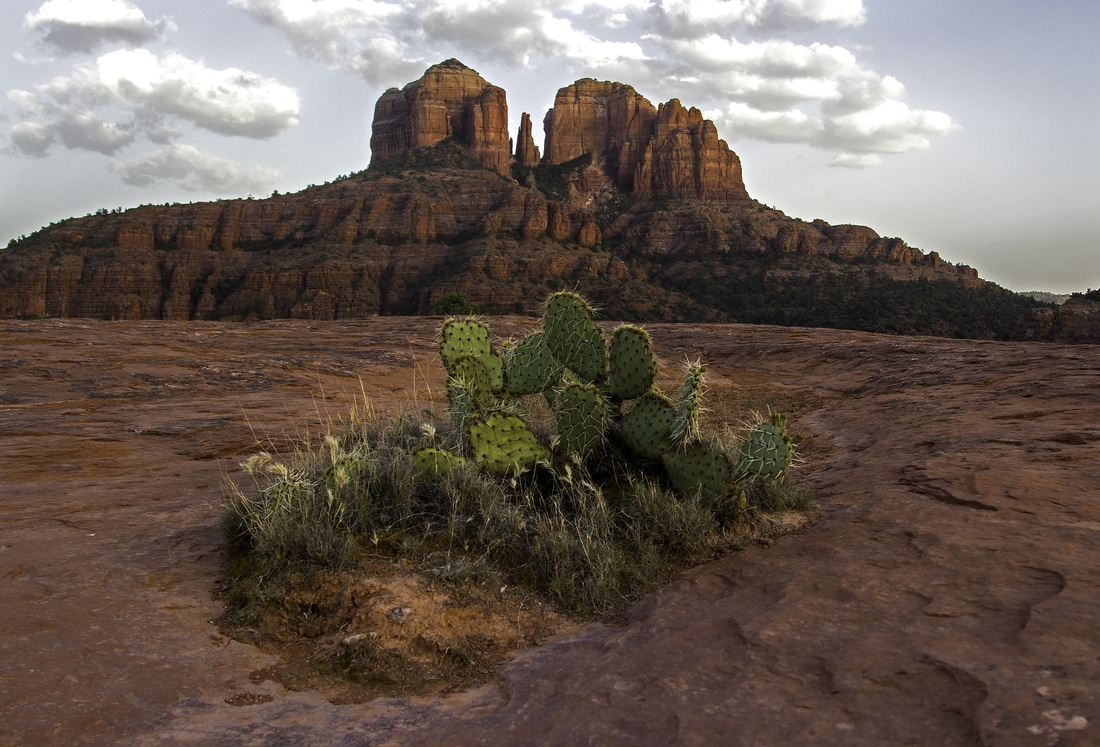
A tough prickly pear cactus survives in the slick rock terrain of Sedona. (Photo by Austin Corbett)
The Teacup Trail to Coffeepot Rock is a fairly easy trail just under 3 miles round-trip.
A slot in the Red Rocks for viewing more of this sublime landscape from the Broken Arrow Trail. (Photo by Austin Corbett)
Dry Creek Road on the southwest edge of Sedona. (Austin Corbett photo)
|
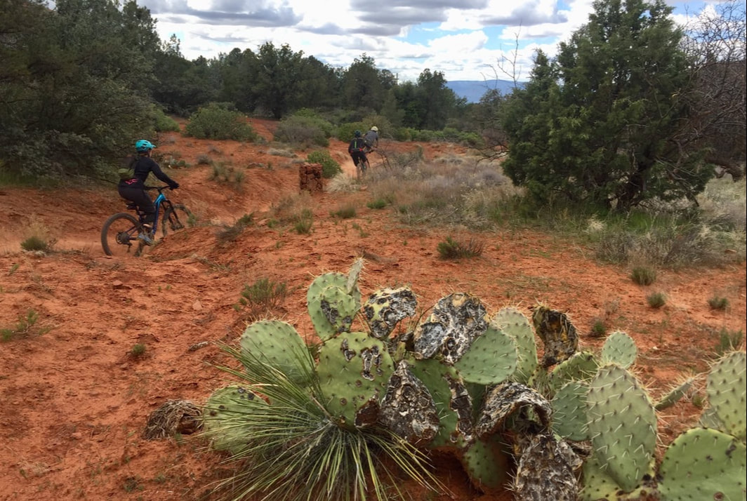
Mountain bikers ride miles of trails in and around Sedona.
|
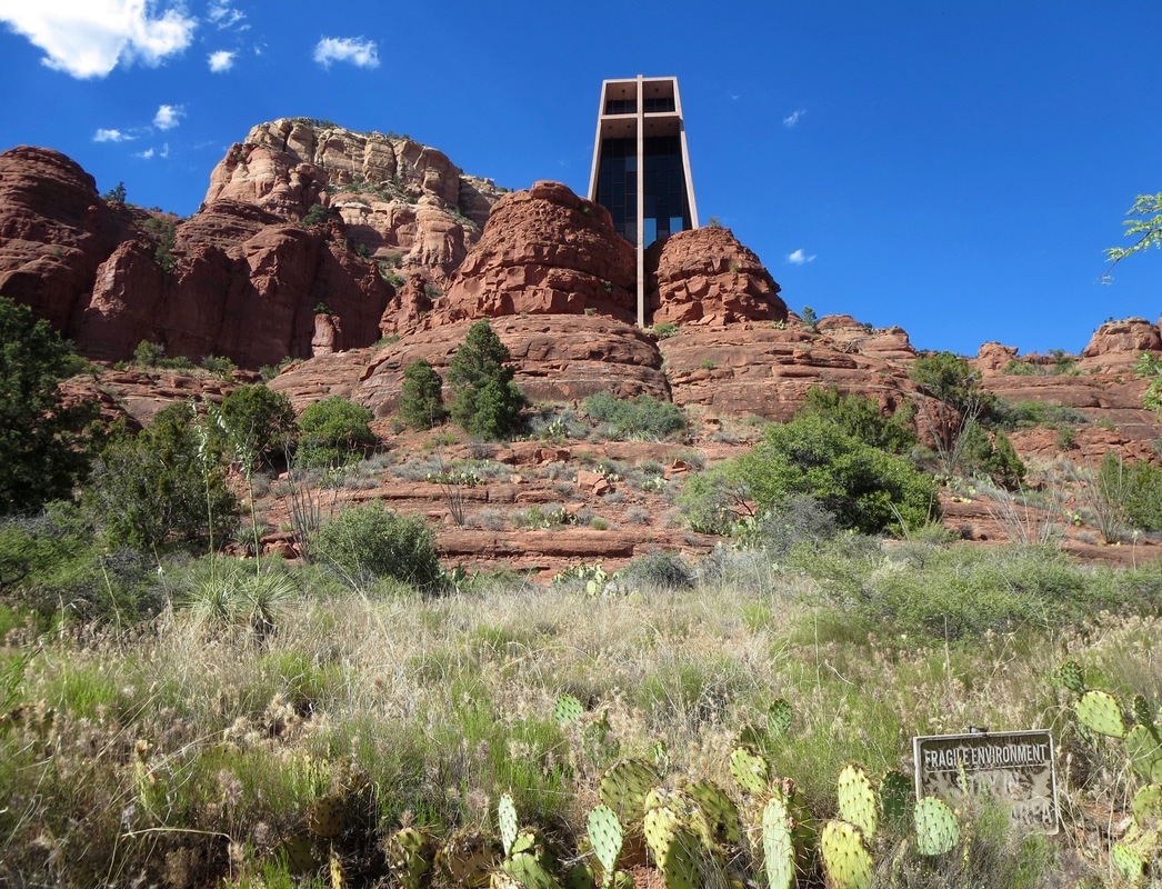
Chapel of the Holy Cross, built in 1956, is on the National Register of Historic Places. The Catholic chapel was designed by Marguerite Brunswig Staude.
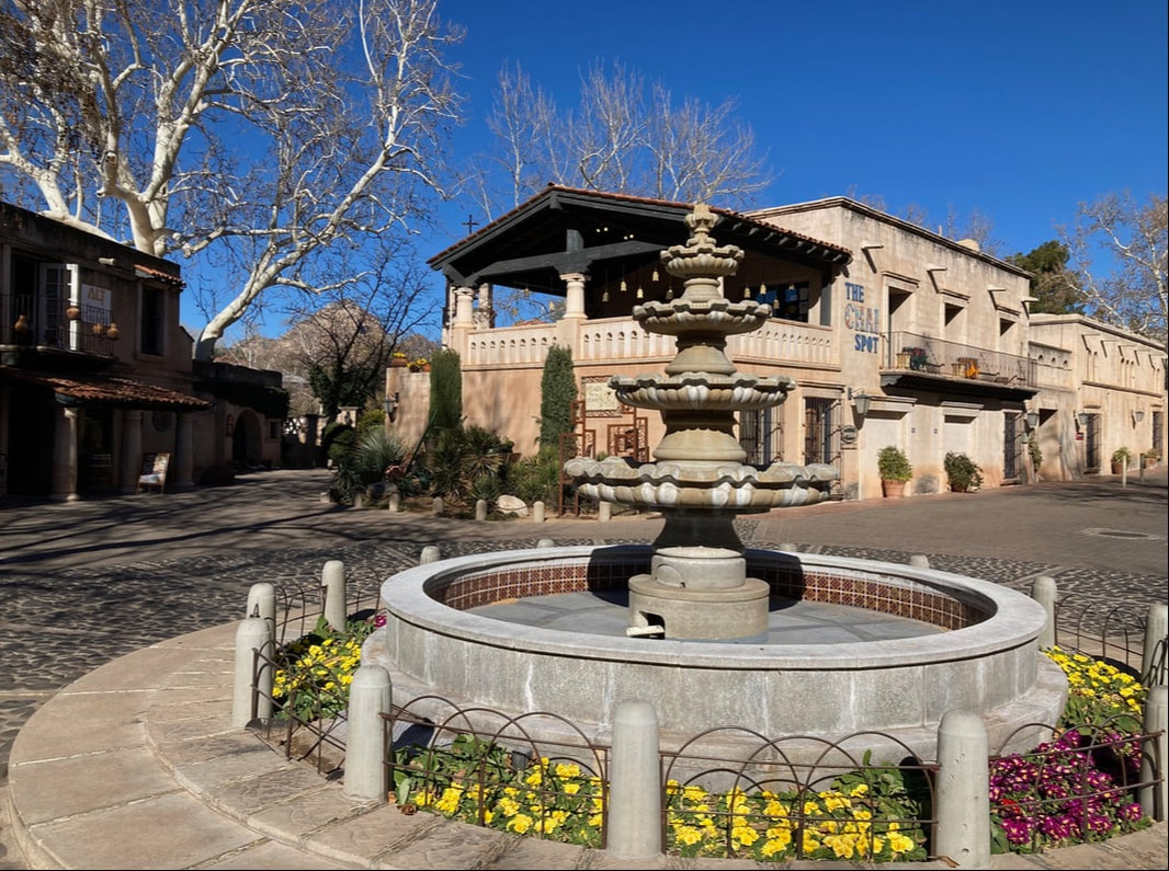
Tlaquepaque, a Spanish Colonial mercado, opened in 1972 along Oak Creek.
|
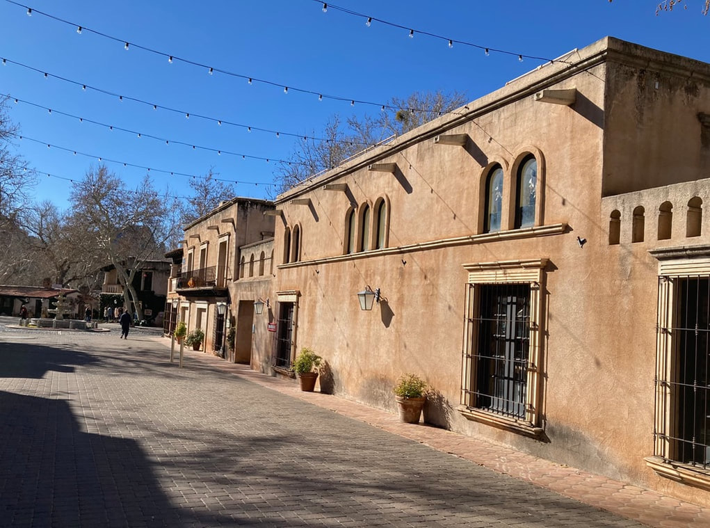
Tlaquepaque is named for a Mexican village southeast of Guadalajara.
|
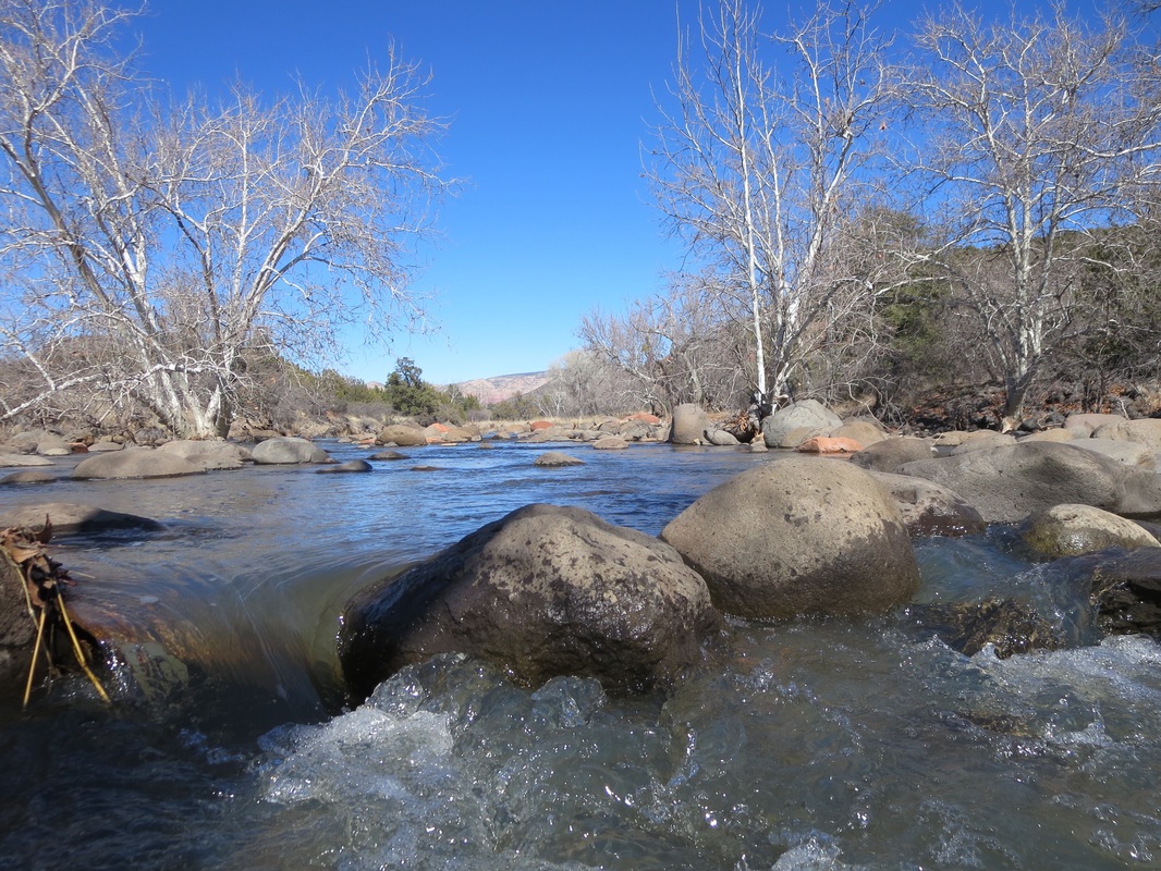
Dry Beaver Creek south of Sedona flows off the rim and runs along SR 179 before emptying into the Verde River.
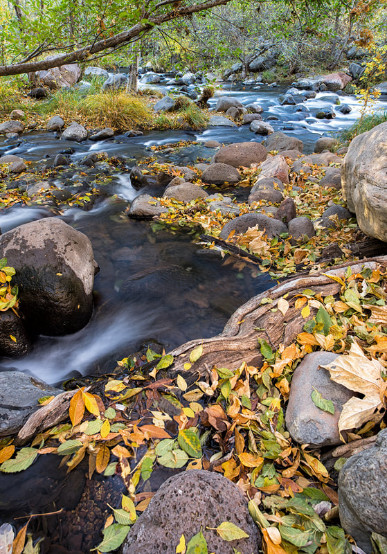
Autumn in Oak Creek Canyon. (Photo by Austin Corbett)