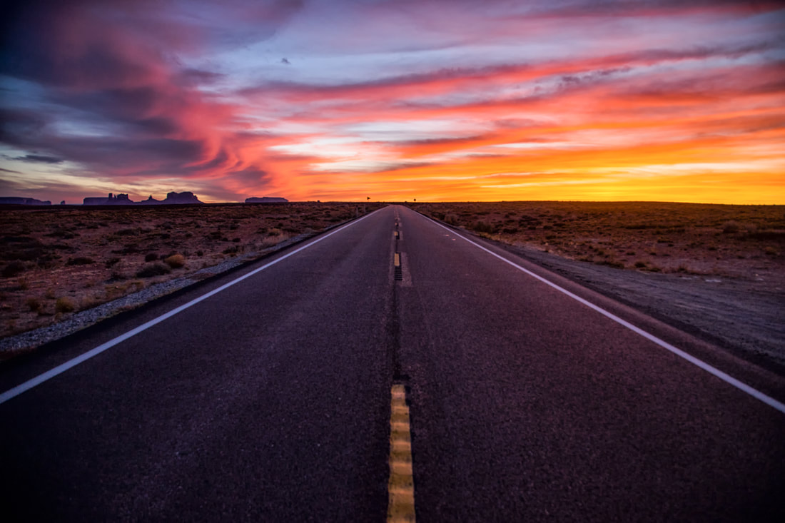
U.S. 163 in Monument Valley, the highway north of Kayenta, Ariz., made famous in films from "Stagecoach" to "Forrest Gump." (Photo by Austin Corbett)
Best Scenic Drives
|
"Many beautiful highways...wind in majestic splendor from one end of the state to the other."
- George W.P. Hunt, Arizona's first governor Arizona's has unending miles of paved highways and back roads traversing some of the world's most spectacular desert, mountain and canyon country. Here are nine of the state's best road trips for scenery and driving pleasure: U.S. 163 from Utah to Kayenta Ideally, this scenic route through Monument Valley is best traveled from north to south since the road descends from a higher elevation near Mexican Hat, Utah into Arizona. To start the journey, we recommend taking Utah 261 south to the switchbacks of what's called the Moki Dugway, descending into Mexican Hat. There's an unpaved loop road off US 163 near the Arizona-Utah border that affords some outstanding John Ford vistas for shutterbugs along this scenic drive. The hard part is capturing the grandeur of this landscape in pictures. U.S. 191 from Clifton-Morenci to Springerville It is known as the Coronado Trail, roughly following the route of Spanish explorer Francisco Vasquez de Coronado who was searching for the fabled "Seven Cities of Cibola" and the rich treasures of gold in 1540. It's still an amazing adventure along 120 miles of twisting, mountain terrain that rises from 3,500 feet to more than 8,000 feet. The views of the surrounding forest and lofty peaks are spectacular along the nearby New Mexico border. The drive takes about three hours but it's well worth it. US 191 is so remote it's lightly traveled. The highway was U.S. 666 -- aka the Devil's Highway -- until 1992. State Route 88 from Apache Junction to Roosevelt Lake *The road is closed indefinitely from Fish Creek Hill to Apache Lake because of storm damage. (Sept. 2019) Known as the Apache Trail, this road is paved to just beyond Tortilla Flat where it gets rough in stretches. The road cuts between the Superstition and Mazatzal mountains, passes Canyon and Apache lakes and includes a narrow stretch of switchbacks down Fish Creek Hill that's white-knuckle narrow. It was built and hacked out of the hillsides in 1904 for construction of Roosevelt Dam that was completed in 1911. Arizona Route 66 from Seligman to Kingman This 80-mile stretch of two-lane blacktop is one of the nation's longest remaining segments of Route 66. There are many road ruins and fading motels left from the heyday of Route 66. Some of the highlights include Seligman's Snow Cap drive-in, Grand Canyon Caverns and Hackberry General Store. Plus, there's miles of open highway to cruise back in time. Other adjoining segments run from west of Ash Fork to Seligman, and Kingman to Oatman and Topock. The alignment from Kingman to Oatman is one of the narrowest and curviest routes on 66 in Arizona. It's an unnerving thrill. State Route 67 from Jacob Lake to Grand Canyon North Rim This scenic route is one of the state's coolest drives, literally. It has pine, fir, spruce and aspen trees, and alpine meadows above 8,000 feet. The 45-mile highway has no commercial development except for one lodge and a store just outside the national park. Sightings of deer, antelope and elk are not uncommon. |
State Route 64 from Grand Canyon to Cameron
This 30-mile drive skirts the East Rim of the national park past Desert View and its watchtower. It then descends to the stark Navajo Reservation before reaching the Cameron Trading Post. There's a scenic overlook at the Little Colorado River Gorge with lots of jewelry stands and other artists selling their work. Just east of the scenic overlook there's an old alignment of the highway with an intact 1934 bridge over what was called Dead Indian Canyon. The structure is about 150 yards south of the current highway and is plainly visible. State Route 89A from Prescott Valley to Jerome Lots of twisties to test your car and driving ability with sheer dropoffs that discourage being too aggressive in the turns. Fabulous views of the Black Hills, Verde Valley and distant San Francisco Peaks. Perkinsville Road from Jerome to Williams Yavapai County Road 72 follows a former railroad route northwest out of Jerome. It's a fairly smooth dirt track that descends to the ranching hamlet of Perkinsville where it crosses the Verde River. The Verde Canyon Railroad has its turnaround at the Perkinsville depot. There are great views of Sedona's red rocks and the Verde Valley's high chaparral country. The last 30 miles are paved on this lightly traveled route through Ponderosa pines as you approach Williams. It takes about 90 minutes to complete this trip. Ajo Mountain Drive in Organ Pipe Cactus National Monument This is one of the best scenic desert roads in Arizona. It's a 21-mile loop road east of State Route 85 and about 34 miles south of Ajo. It's a fairly well graded unpaved road with pavement in many washes and some paved sections on steeper slopes. See the Best Arizona Saloons: http://www.ontheroadarizona.com/bestbars.html |

Apache Trail is bracketed by Roosevelt Lake and Canyon Lake with Apache Lake (shown here) in between the two. (Photo by Austin Corbett)
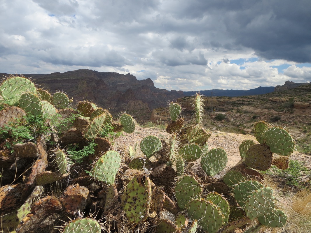
Prickly Pear cactus and a threatening sky along the Apache Trail.
|
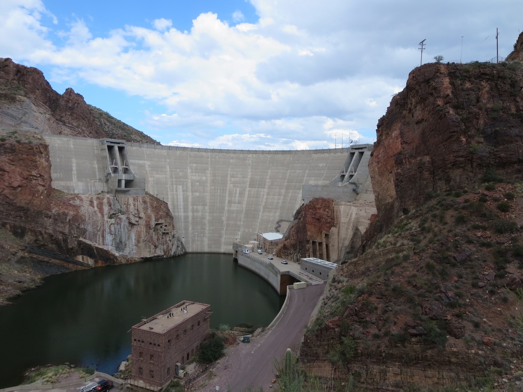
Apache Trail was used to build
the Roosevelt Dam starting in 1905.
|
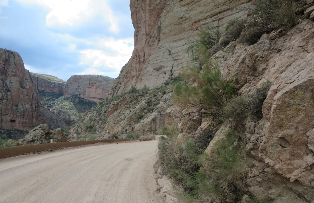
Switchbacks on State Route 88, the Apache Trail, wind down the narrow, crooked and sometimes treacherous Fish Creek Hill.
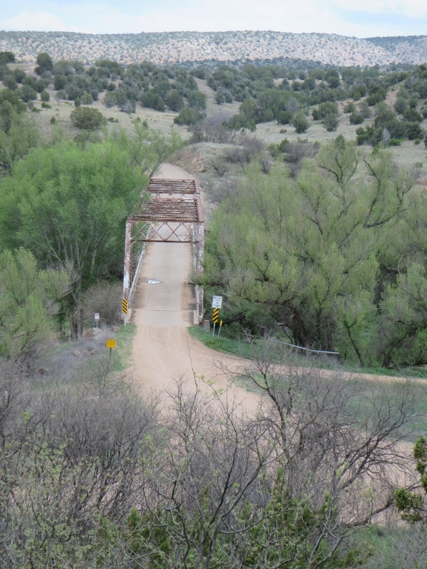
Perkinsville Road crosses the Verde River north of Jerome.
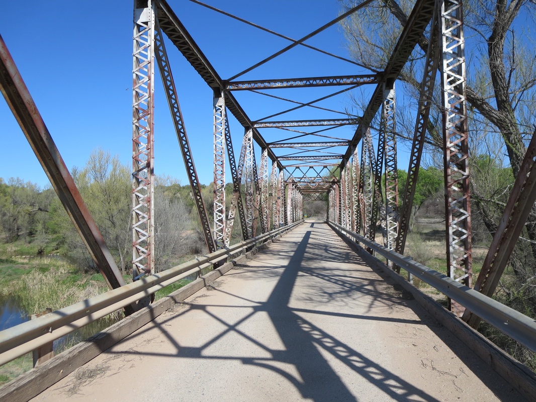
The Perkinsville Bridge was moved from the Gila River in 1936.
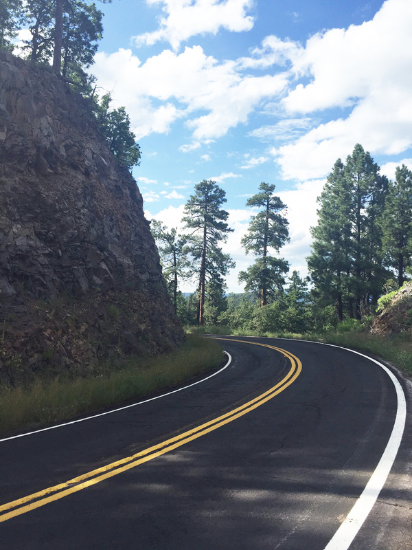
U.S. 191, the Coronado Trail connects Clifton to Springerville.
|
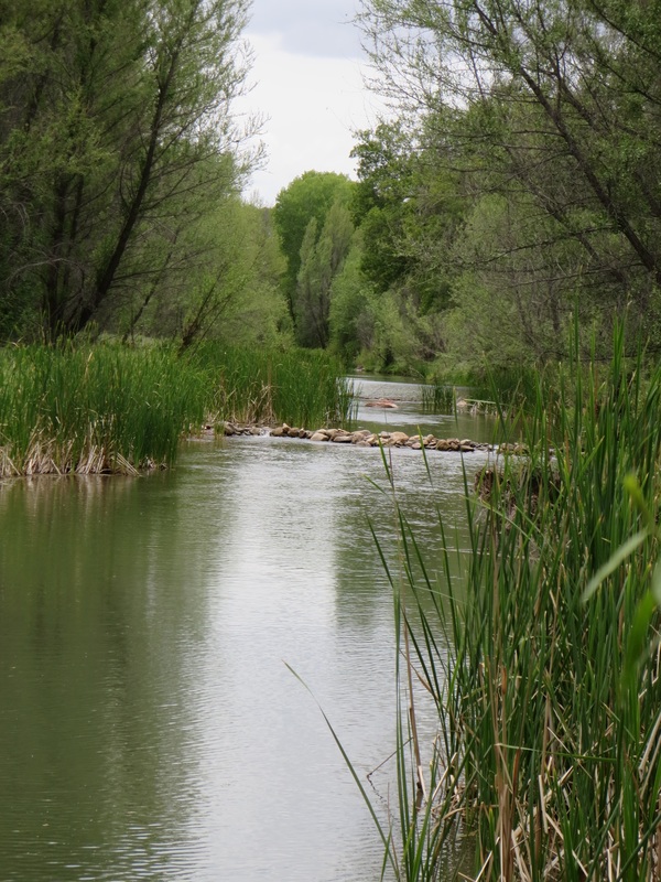
The slow-flowing Verde River near the Perkinsville Bridge.
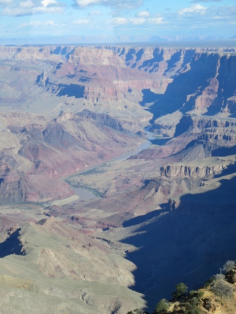
The Colorado River from Desert View along State Route 64.
The Verde Canyon Railroad stops at the nearby Perkinsville depot.
|
State Route 67, which traverses forests and alpine meadows above 8,000 feet, is open from May 15 to Dec. 1. It's 45 miles from Jacob Lake to the North Rim.
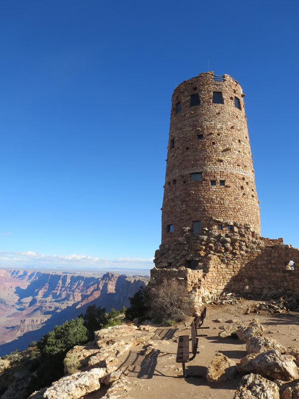
Desert Watchtower along the East Rim of the Grand Canyon.
|
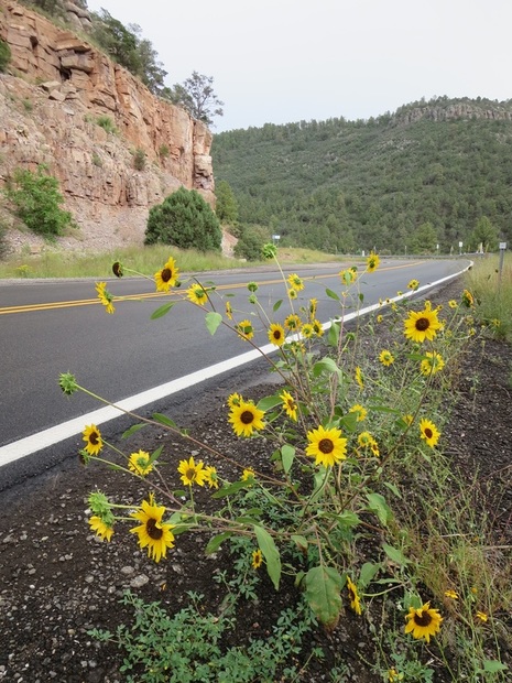
Wildflowers along SR 89A on Mingus Mountain near Jerome.
|
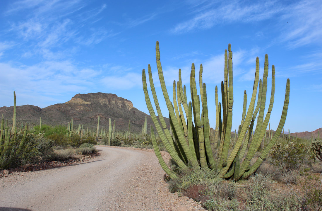
Ajo Mountain Drive is a 21-mile unpaved loop road in Organ Pipe Cactus National Monument south of Ajo, Ariz.