ON THE ROAD ARIZONA
  • Home
    • About
    • Contact
  • Best of Arizona
    • Historic Maps
    • Best Arizona Events
    • Best Cycling Route
    • Best Scenic Drives
    • Best Saloons
    • Best Cactus League Ballparks
    • Best Vintage Neon
    • Best Bridges
    • Best Place Names
    • Best Historic Hotels
    • Best Road Songs
    • Best Historic Lodges
    • Arizona state symbols
    • Best Ways to Stay Safe
    • Best Metro Phoenix Resorts
  • Route 66
    • Ash Fork
    • Bellemont
    • Flagstaff Route 66
    • Hackberry
    • Holbrook Route 66
    • Joseph City
    • Kingman Route 66
    • Lupton
    • Oatman
    • Peach Springs
    • Seligman
    • Truxton
    • Twin Arrows
    • Two Guns
    • Williams
    • Winslow Route 66
  • Towns (A-F)
    • Ajo
    • Bisbee
    • Camp Verde
    • Cave Creek
    • Clarkdale
    • Clifton
    • Cottonwood
    • Douglas
    • Flagstaff
    • Florence
  • Towns (G-P)
    • Globe
    • Holbrook
    • Jerome
    • Kingman
    • Lake Havasu City
    • Mesa
    • Miami
    • Page
    • Payson
    • Prescott
  • Towns Q-Z
    • Salome
    • Scottsdale
    • Sedona
    • Superior
    • Tombstone
    • Tucson
    • Wickenburg
    • Willcox
    • Winslow
    • Yuma
  • Natl Parks
    • Canyon de Chelly
    • Chiricahua NM
    • Grand Canyon North Rim
    • Grand Canyon South Rim
    • Granite Mtn. Hotshots Memorial
    • Hubbell Trading Post
    • Jerome State Historic Park
    • Montezuma Castle NM
    • Navajo National Monument
    • Organ Pipe National Monument
    • Petrified Forest NP
    • Saguaro NP
    • San Xavier del Bac Mission
    • Sunset Crater Volcano NM
    • Superstitions
    • Tumacacori NHP
    • Tuzigoot NM
    • Walnut Canyon NM
    • Wupatki NM

Walnut Canyon

 Viewing the cliff dwellings at Walnut Canyon National Monument requires a 0.9-mile walk on the Island Trail and a climb of 185 feet up 240 steps at an elevation of just less than 6,700 feet. The trail is  a nice hourlong walk for visitors who are reasonably fit. 

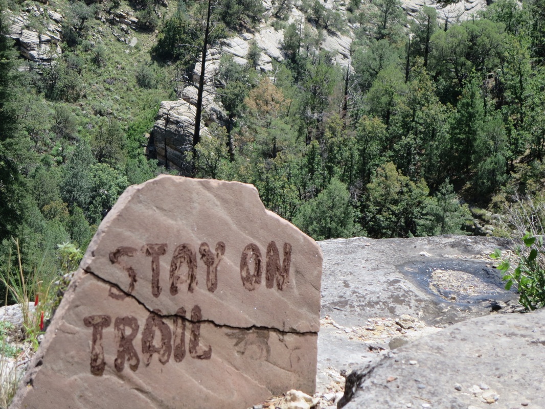
The 0.7-mile Rim Trail is an easier walk that takes about 30 minutes.

None of the pictographs and petroglyphs in Walnut Canyon are visible from the monument's trails. 

The 24 cliff dwellings were built in the limestone cliffs from 1125 to 1250 A.D. The Sinagua native people moved away to new villages after 1250 and it's believed they assimilated into the Hopi culture. The Hopi called them Hisatsinom or "the people of long ago," according to the National Park Service.

Pot hunters removed many relics from Walnut Canyon starting in the late 1800s. The Forest Service built a ranger cabin in 1904 to protect Walnut Canyon. It  was not protected as a national monument until 1915. ​
There are close to 500 archeological sites within Walnut Canyon, which runs for about 10 miles.  Not all of canyon is within the national monument boundaries.

A study from a decade ago found 2,000 walnut trees at the bottom of the 400-foot canyon. 

Park admission is $15 per person for visitors 16 and older or $45 for 4 visitors for an entire year that also allows free entrance into Sunset Crater Volcanic National Monument and Wupatki National Monument.

​The park is 7.5 miles east of Flagstaff at Exit 204 on Interstate 40 and it's 3 miles south to the visitor center.

​Established: 1915
Elevation: 6,690 feet.
Annual visitation: 152,548

Take a side trip to nearby Sunset Crater National Monument:

http://www.ontheroadarizona.com/sunsetcrater.html
Picture
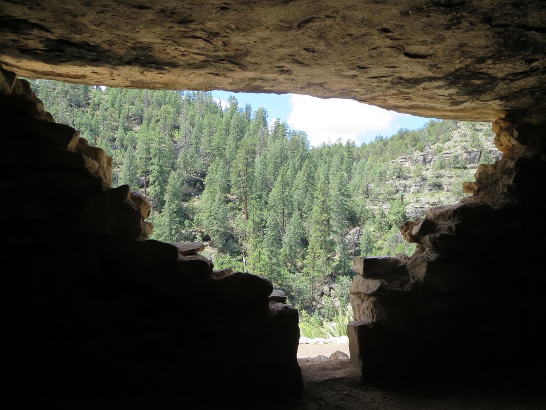
Looking out on the Ponderosa pines from a cliff dwelling in Walnut Canyon National Monument east of Flagstaff.
Picture
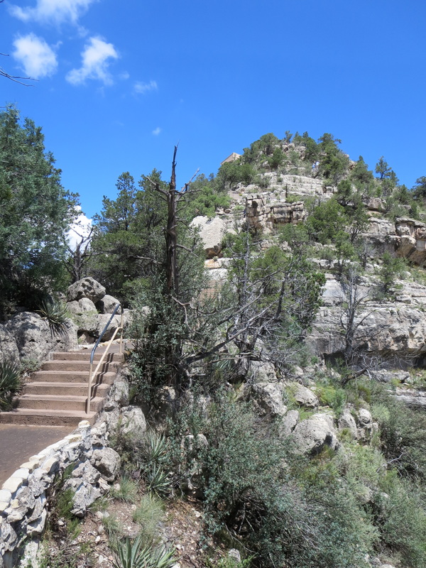
Visitors can tour the ruins on a loop trail.
Picture
Picture
A mountain bike path runs through Walnut Canyon outside the national monument boundary. (Austin Corbett photo)
Proudly powered by Weebly
  • Home
    • About
    • Contact
  • Best of Arizona
    • Historic Maps
    • Best Arizona Events
    • Best Cycling Route
    • Best Scenic Drives
    • Best Saloons
    • Best Cactus League Ballparks
    • Best Vintage Neon
    • Best Bridges
    • Best Place Names
    • Best Historic Hotels
    • Best Road Songs
    • Best Historic Lodges
    • Arizona state symbols
    • Best Ways to Stay Safe
    • Best Metro Phoenix Resorts
  • Route 66
    • Ash Fork
    • Bellemont
    • Flagstaff Route 66
    • Hackberry
    • Holbrook Route 66
    • Joseph City
    • Kingman Route 66
    • Lupton
    • Oatman
    • Peach Springs
    • Seligman
    • Truxton
    • Twin Arrows
    • Two Guns
    • Williams
    • Winslow Route 66
  • Towns (A-F)
    • Ajo
    • Bisbee
    • Camp Verde
    • Cave Creek
    • Clarkdale
    • Clifton
    • Cottonwood
    • Douglas
    • Flagstaff
    • Florence
  • Towns (G-P)
    • Globe
    • Holbrook
    • Jerome
    • Kingman
    • Lake Havasu City
    • Mesa
    • Miami
    • Page
    • Payson
    • Prescott
  • Towns Q-Z
    • Salome
    • Scottsdale
    • Sedona
    • Superior
    • Tombstone
    • Tucson
    • Wickenburg
    • Willcox
    • Winslow
    • Yuma
  • Natl Parks
    • Canyon de Chelly
    • Chiricahua NM
    • Grand Canyon North Rim
    • Grand Canyon South Rim
    • Granite Mtn. Hotshots Memorial
    • Hubbell Trading Post
    • Jerome State Historic Park
    • Montezuma Castle NM
    • Navajo National Monument
    • Organ Pipe National Monument
    • Petrified Forest NP
    • Saguaro NP
    • San Xavier del Bac Mission
    • Sunset Crater Volcano NM
    • Superstitions
    • Tumacacori NHP
    • Tuzigoot NM
    • Walnut Canyon NM
    • Wupatki NM