ON THE ROAD ARIZONA
  • Home
    • About
    • Contact
  • Best of Arizona
    • Historic Maps
    • Best Arizona Events
    • Best Cycling Route
    • Best Scenic Drives
    • Best Saloons
    • Best Cactus League Ballparks
    • Best Vintage Neon
    • Best Bridges
    • Best Place Names
    • Best Historic Hotels
    • Best Road Songs
    • Best Historic Lodges
    • Arizona state symbols
    • Best Ways to Stay Safe
    • Best Metro Phoenix Resorts
  • Route 66
    • Ash Fork
    • Bellemont
    • Flagstaff Route 66
    • Hackberry
    • Holbrook Route 66
    • Joseph City
    • Kingman Route 66
    • Lupton
    • Oatman
    • Peach Springs
    • Seligman
    • Truxton
    • Twin Arrows
    • Two Guns
    • Williams
    • Winslow Route 66
  • Towns (A-F)
    • Ajo
    • Bisbee
    • Camp Verde
    • Cave Creek
    • Clarkdale
    • Clifton
    • Cottonwood
    • Douglas
    • Flagstaff
    • Florence
  • Towns (G-P)
    • Globe
    • Holbrook
    • Jerome
    • Kingman
    • Lake Havasu City
    • Mesa
    • Miami
    • Page
    • Payson
    • Prescott
  • Towns Q-Z
    • Salome
    • Scottsdale
    • Sedona
    • Superior
    • Tombstone
    • Tucson
    • Wickenburg
    • Willcox
    • Winslow
    • Yuma
  • Natl Parks
    • Canyon de Chelly
    • Chiricahua NM
    • Grand Canyon North Rim
    • Grand Canyon South Rim
    • Granite Mtn. Hotshots Memorial
    • Hubbell Trading Post
    • Jerome State Historic Park
    • Montezuma Castle NM
    • Navajo National Monument
    • Organ Pipe National Monument
    • Petrified Forest NP
    • Saguaro NP
    • San Xavier del Bac Mission
    • Sunset Crater Volcano NM
    • Superstitions
    • Tumacacori NHP
    • Tuzigoot NM
    • Walnut Canyon NM
    • Wupatki NM
Picture

Sunset Crater Volcano National Monument

Picture
Visitors at one time could hike up the 8,039-foot Sunset Crater cinder cone but the foot traffic caused too much erosion and the practice was halted.

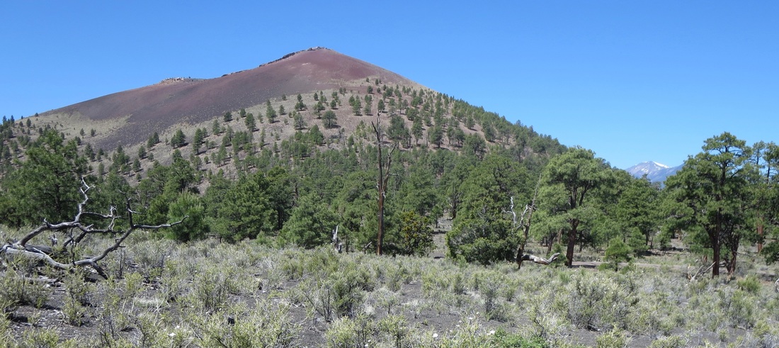
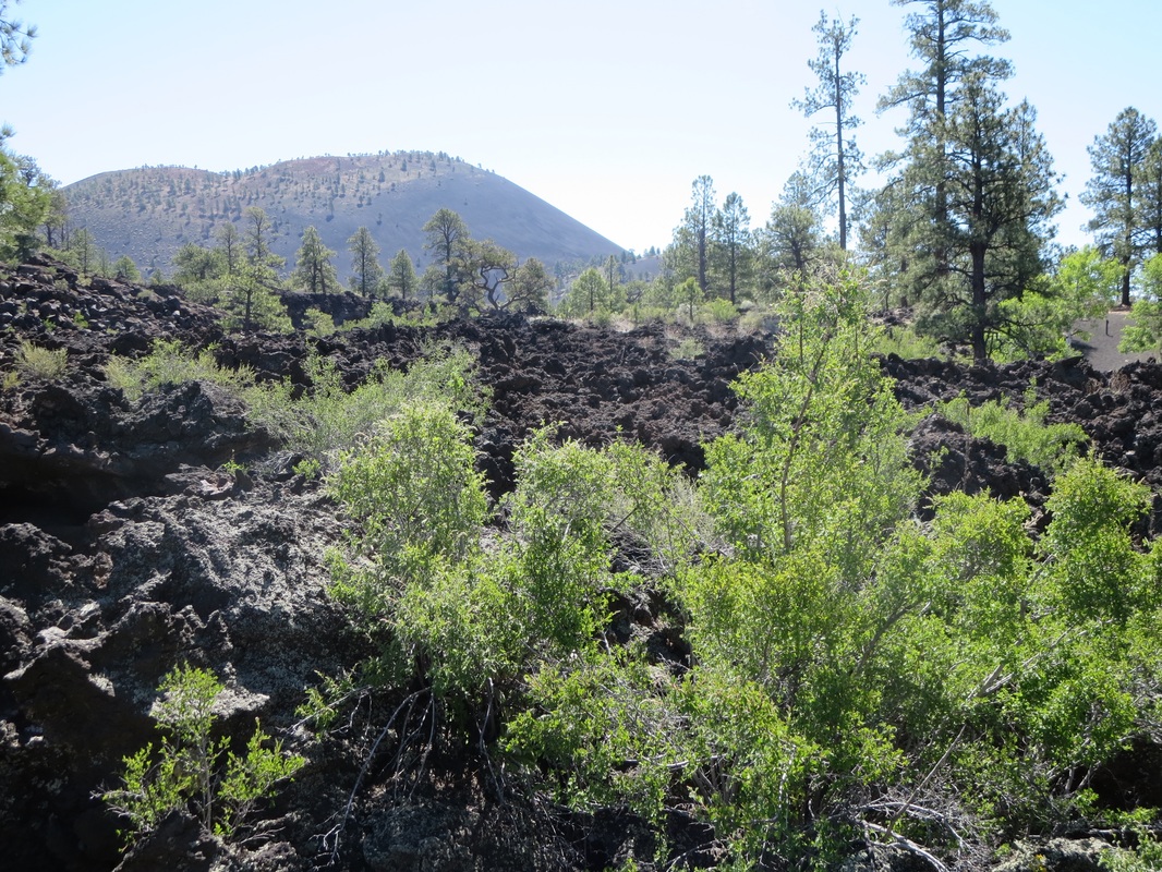
Lava flowed in 1200 A.D. at Sunset Crater
​

Sunset Crater Volcano  and the adjacent Wupatki national monuments are often overlooked by tourists eager to get to Grand Canyon National Park. But visitors would be wise to take a little extra time to include these parks in their itinerary.

Instead of driving on U.S. 180 or State Route 64 to the South Rim of the Grand Canyon, take U.S. 89 out of Flagstaff a dozen miles north to Sunset Crater and then on to Wupatki. This scenic detour  adds about an hour of extra driving time but the rewards are many. That includes a scenic first look at the South Rim at Desert Watchtower from the park's eastern entrance.

(Grand Canyon's east entrance reopened April 8, 2021 after being closed for the past year because of Covid-19 restrictions.)

Sunset Crater erupted around 1200 A.D. and is the most recent event in the 3,000-square-mile San Francisco Volcanic Field. Hike 
in a lava field, get close to the cinder cone of 8,039-foot Sunset Crater and learn about the area's geology at the Visitor Center. ​Bonito Campground has sites shaded by tall Ponderosa pines. It's open from May to October. Vehicles are limited to 40 feet or less and there are no trailer hookups or showers.

​The 35-mile (56-kilometer) scenic loop road offers views of the majestic San Francisco Peaks, mesas of the Wupatki Basin and Painted Desert. It's generally lightly traveled and carries far less traffic than U.S. 89. It descends about 2,000 feet from Sunset Crater to Wupatki. The road is popular with cyclists.

Admission is $25 per vehicle, allowing entry to both Sunset Crater and Wupatki national monuments.

Established: 1930
Elevation: 6,960 at Visitor Center; 8,039 Sunset Crater
Annual visitation: 125,653

Wupataki National Monument is 15 minutes away:
http://www.ontheroadarizona.com/wupatki.html
Picture
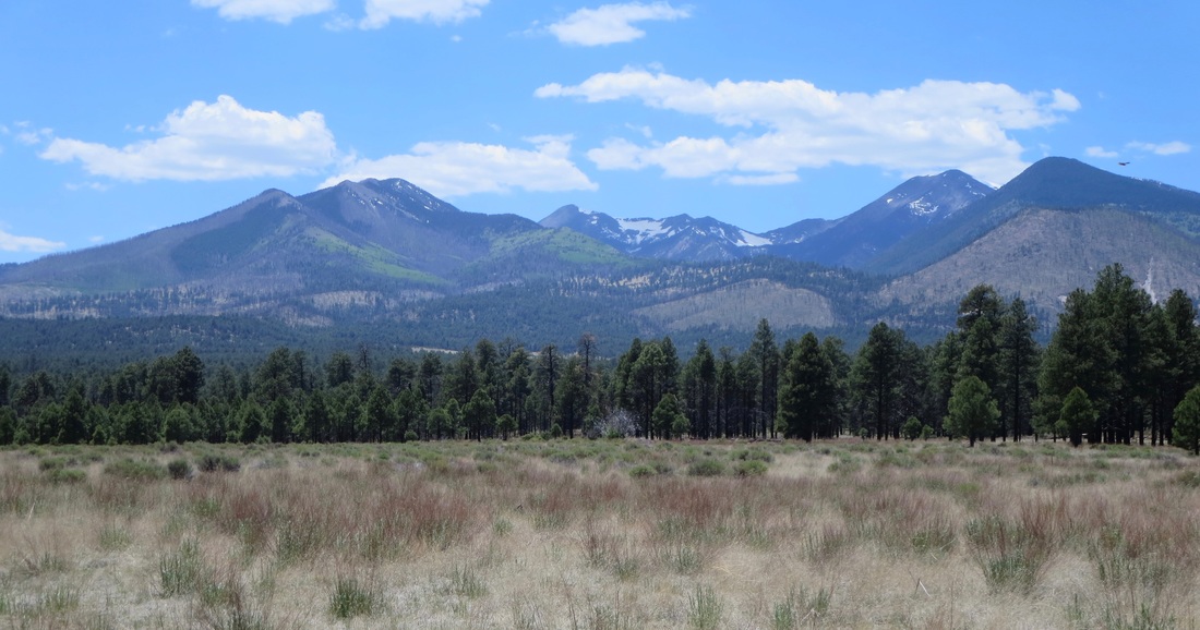
Bonito Park offers wide-open views of the Inner Basin of the 12,600-foot San Francisco Peaks.
Picture
Picture
Picture
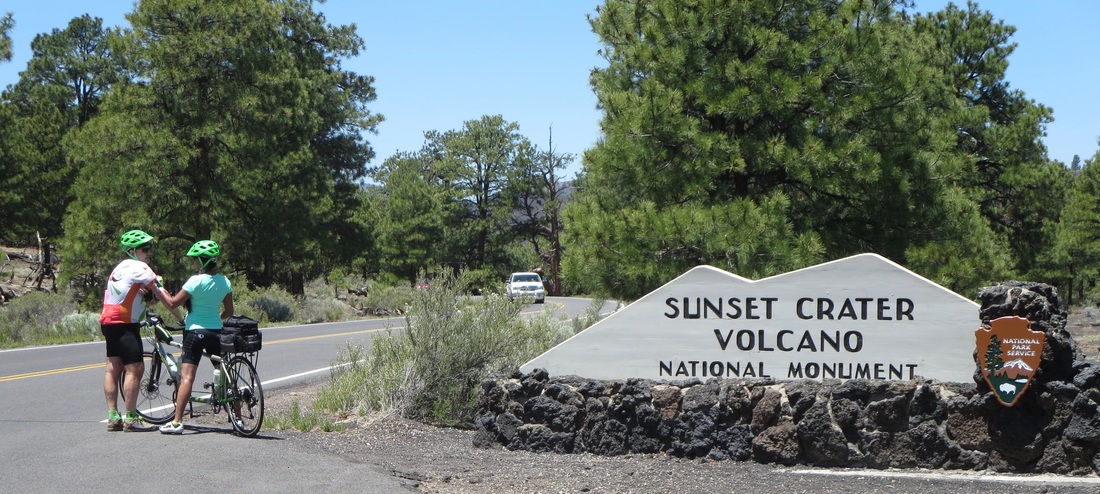
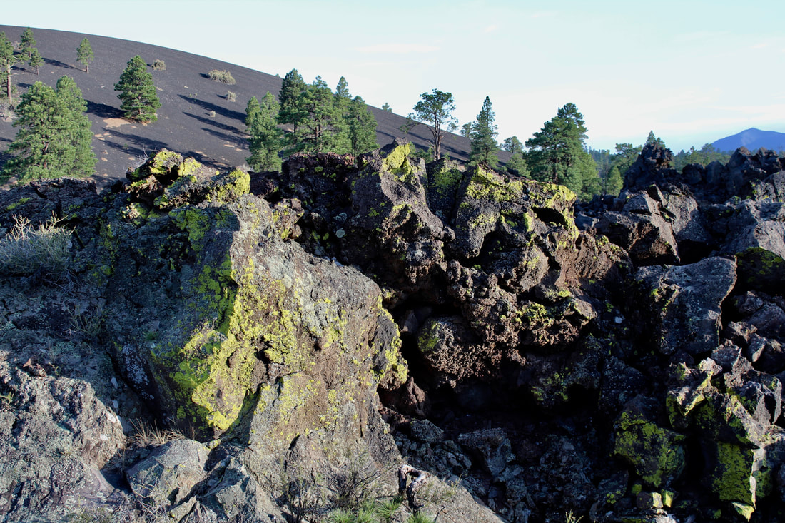
Cyclists, including these two on a tandem bike, ride the lightly traveled scenic loop road that descends 2,000 feet from Sunset Crater to Wupatki. Right: Vegetation has grown in the crevices of a lava field over the past 800 years since Sunset Crater erupted.
Picture
Proudly powered by Weebly
  • Home
    • About
    • Contact
  • Best of Arizona
    • Historic Maps
    • Best Arizona Events
    • Best Cycling Route
    • Best Scenic Drives
    • Best Saloons
    • Best Cactus League Ballparks
    • Best Vintage Neon
    • Best Bridges
    • Best Place Names
    • Best Historic Hotels
    • Best Road Songs
    • Best Historic Lodges
    • Arizona state symbols
    • Best Ways to Stay Safe
    • Best Metro Phoenix Resorts
  • Route 66
    • Ash Fork
    • Bellemont
    • Flagstaff Route 66
    • Hackberry
    • Holbrook Route 66
    • Joseph City
    • Kingman Route 66
    • Lupton
    • Oatman
    • Peach Springs
    • Seligman
    • Truxton
    • Twin Arrows
    • Two Guns
    • Williams
    • Winslow Route 66
  • Towns (A-F)
    • Ajo
    • Bisbee
    • Camp Verde
    • Cave Creek
    • Clarkdale
    • Clifton
    • Cottonwood
    • Douglas
    • Flagstaff
    • Florence
  • Towns (G-P)
    • Globe
    • Holbrook
    • Jerome
    • Kingman
    • Lake Havasu City
    • Mesa
    • Miami
    • Page
    • Payson
    • Prescott
  • Towns Q-Z
    • Salome
    • Scottsdale
    • Sedona
    • Superior
    • Tombstone
    • Tucson
    • Wickenburg
    • Willcox
    • Winslow
    • Yuma
  • Natl Parks
    • Canyon de Chelly
    • Chiricahua NM
    • Grand Canyon North Rim
    • Grand Canyon South Rim
    • Granite Mtn. Hotshots Memorial
    • Hubbell Trading Post
    • Jerome State Historic Park
    • Montezuma Castle NM
    • Navajo National Monument
    • Organ Pipe National Monument
    • Petrified Forest NP
    • Saguaro NP
    • San Xavier del Bac Mission
    • Sunset Crater Volcano NM
    • Superstitions
    • Tumacacori NHP
    • Tuzigoot NM
    • Walnut Canyon NM
    • Wupatki NM