ON THE ROAD ARIZONA
  • Home
    • About
    • Contact
  • Best of Arizona
    • Historic Maps
    • Best Arizona Events
    • Best Cycling Route
    • Best Scenic Drives
    • Best Saloons
    • Best Cactus League Ballparks
    • Best Vintage Neon
    • Best Bridges
    • Best Place Names
    • Best Historic Hotels
    • Best Road Songs
    • Best Historic Lodges
    • Arizona state symbols
    • Best Ways to Stay Safe
    • Best Metro Phoenix Resorts
  • Route 66
    • Ash Fork
    • Bellemont
    • Flagstaff Route 66
    • Hackberry
    • Holbrook Route 66
    • Joseph City
    • Kingman Route 66
    • Lupton
    • Oatman
    • Peach Springs
    • Seligman
    • Truxton
    • Twin Arrows
    • Two Guns
    • Williams
    • Winslow Route 66
  • Towns (A-F)
    • Ajo
    • Bisbee
    • Camp Verde
    • Cave Creek
    • Clarkdale
    • Clifton
    • Cottonwood
    • Douglas
    • Flagstaff
    • Florence
  • Towns (G-P)
    • Globe
    • Holbrook
    • Jerome
    • Kingman
    • Lake Havasu City
    • Mesa
    • Miami
    • Page
    • Payson
    • Prescott
  • Towns Q-Z
    • Salome
    • Scottsdale
    • Sedona
    • Superior
    • Tombstone
    • Tucson
    • Wickenburg
    • Willcox
    • Winslow
    • Yuma
  • Natl Parks
    • Canyon de Chelly
    • Chiricahua NM
    • Grand Canyon North Rim
    • Grand Canyon South Rim
    • Granite Mtn. Hotshots Memorial
    • Hubbell Trading Post
    • Jerome State Historic Park
    • Montezuma Castle NM
    • Navajo National Monument
    • Organ Pipe National Monument
    • Petrified Forest NP
    • Saguaro NP
    • San Xavier del Bac Mission
    • Sunset Crater Volcano NM
    • Superstitions
    • Tumacacori NHP
    • Tuzigoot NM
    • Walnut Canyon NM
    • Wupatki NM
Picture
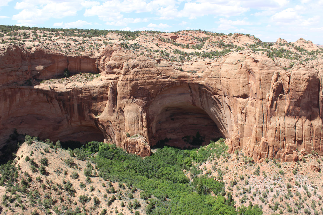
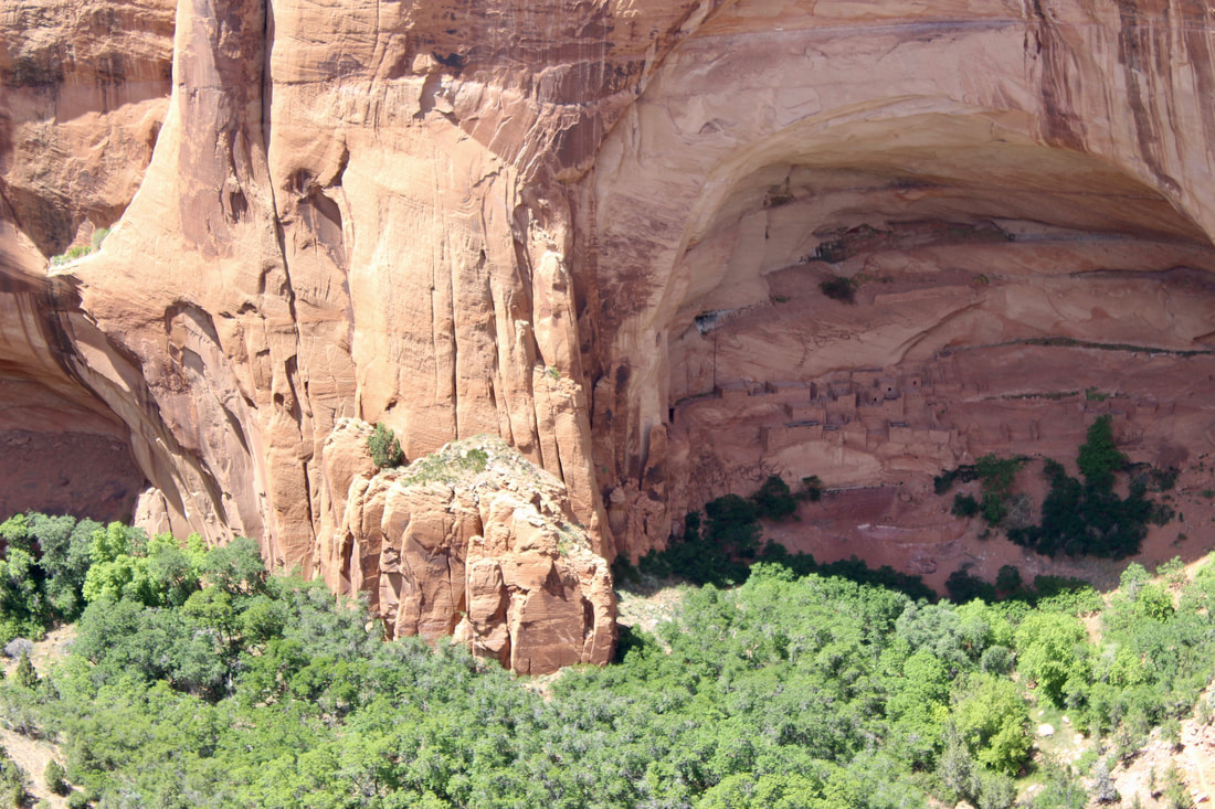
Betatakin cliff dwelling was occupied from about 1250 to 1300. It is shaded in summer but warmed by the low winter sun.

Navajo National Monument

It's understandable that Navajo National Monument flies under the radar for most Arizonans and visitors. It's overshadowed by Monument Valley 45 minutes away to the northeast and Grand Canyon's South Rim a 2 1/2 hour-drive to the southwest. 

I finally visited this spring. I want to go back because I didn't  leave myself enough time to really see the park. The Sandal Trail gives visitors a quick look at the Betatakin cliff dwelling in the canyon. It's a 1.3 mile roundtrip on a paved trail to an overlook.

Ancestral Puebloans, previously referred to as Anasazi, lived at Batatakin from about 1250 to 1300. 

Another dwelling called Keet Seel is one of the best preserved sites in the Southwest, according to the monument guide literature. As many as 150 people lived there starting around 950 and ending by 1300. 

Guided tours of both dwellings are offered. The Betatakin tour involves a 5-mile round-trip hike that takes three to five hours. 

The Keet Seel tour requires a strenuous 17-mile round-trip hike with some water crossings. 

Check at the visitor center or call the park (928-672-2700) for details on the tours.

Navajo National Monument is in a remote and arid region of the Navajo Reservation but it's a bit cooler than other areas because of its elevation of 7,300 feet. Still, I would recommend avoiding midday visits during mid-summer. Conversely, winter can be cold and windy on these mesas.
Picture
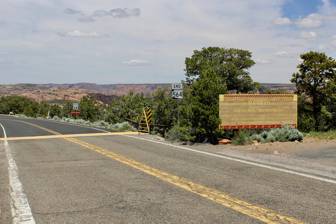
Navajo National Monument is 9 miles north of US 160 on State Route 564.
Admission to Navajo National Monument is free and the two campgrounds are free. 

The Sunset View Campground, open year-round, has 31 sites with picnic tables,  potable water, restrooms and charcoal grills. No wood fires are allowed in the park. RVs are limited to 28 feet and there are no hookups or dump stations.

Canyon View Campground has 14 sites for tent camping and pit toilets. It's open April 1 to Sept. 30.

Established: 1909
​Elevation: 7,300 feet 
Annual Visitation: 14,834

A visit to Canyon de Chelly National Monument is about 100 miles away to the southeast: http://www.ontheroadarizona.com/canyondechelly.html
Picture
Rangers lead guided hikes to the Betatakin and Keet Seel cliff dwellings. There are fir and aspen trees within the canyon.
Picture
Picture
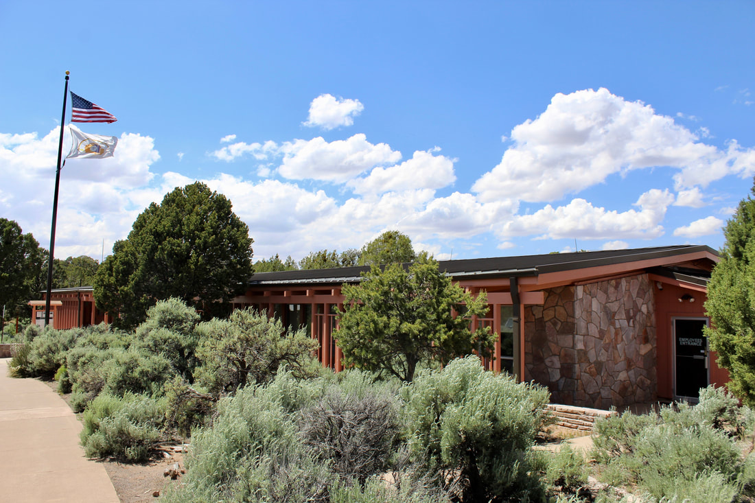
Check at the visitors center for details on the guided tours another information about Navajo National Monument.
Proudly powered by Weebly
  • Home
    • About
    • Contact
  • Best of Arizona
    • Historic Maps
    • Best Arizona Events
    • Best Cycling Route
    • Best Scenic Drives
    • Best Saloons
    • Best Cactus League Ballparks
    • Best Vintage Neon
    • Best Bridges
    • Best Place Names
    • Best Historic Hotels
    • Best Road Songs
    • Best Historic Lodges
    • Arizona state symbols
    • Best Ways to Stay Safe
    • Best Metro Phoenix Resorts
  • Route 66
    • Ash Fork
    • Bellemont
    • Flagstaff Route 66
    • Hackberry
    • Holbrook Route 66
    • Joseph City
    • Kingman Route 66
    • Lupton
    • Oatman
    • Peach Springs
    • Seligman
    • Truxton
    • Twin Arrows
    • Two Guns
    • Williams
    • Winslow Route 66
  • Towns (A-F)
    • Ajo
    • Bisbee
    • Camp Verde
    • Cave Creek
    • Clarkdale
    • Clifton
    • Cottonwood
    • Douglas
    • Flagstaff
    • Florence
  • Towns (G-P)
    • Globe
    • Holbrook
    • Jerome
    • Kingman
    • Lake Havasu City
    • Mesa
    • Miami
    • Page
    • Payson
    • Prescott
  • Towns Q-Z
    • Salome
    • Scottsdale
    • Sedona
    • Superior
    • Tombstone
    • Tucson
    • Wickenburg
    • Willcox
    • Winslow
    • Yuma
  • Natl Parks
    • Canyon de Chelly
    • Chiricahua NM
    • Grand Canyon North Rim
    • Grand Canyon South Rim
    • Granite Mtn. Hotshots Memorial
    • Hubbell Trading Post
    • Jerome State Historic Park
    • Montezuma Castle NM
    • Navajo National Monument
    • Organ Pipe National Monument
    • Petrified Forest NP
    • Saguaro NP
    • San Xavier del Bac Mission
    • Sunset Crater Volcano NM
    • Superstitions
    • Tumacacori NHP
    • Tuzigoot NM
    • Walnut Canyon NM
    • Wupatki NM