Payson
|
Payson is easy for desert travelers to overlook since so many of them head further north and east to higher elevation destinations on the Mogollon Rim and in the national forests. Many visitors stop for gas or a meal at the Bee Line or Pinon Cafe. But there are local attractions, hiking trails and nearby campgrounds that are good reasons to stick around for a day, a weekend or longer.
The town also hosts one of Arizona’s longest running events, the Payson Rodeo. It started in 1884 with roping and riding events and for a time was held on Main Street, when it was known as the August Doin’s. Payson boasts it’s the world’s Longest Continuously Operating Rodeo. Prescott Rodeo backers dispute that but the record seems unclear on equestrian and cowboy competitions from 136 years ago. A more recent Payson event is the Old Time Fiddle & Acoustic Celebration that's been entertaining Arizonans for a half century. It will be staged Sept. 23-25, 2022 at Green Valley Park. It's a delightful small town festival of fiddle and bluegrass music that I attended in the mid-1970s. Since then I haven't spent much time in Payson, except for passing through on dozens of trips to somewhere else. I returned to explore Payson a few years ago and I found much to like about the town. My first stop was at Green Valley Park, more than a mile west of State Route 87 at the end of Main Street. A half-mile walking path circles a lake with fountains and fishing. The park is also home to the Rim Country Museum, with an extensive collection of historical artifacts of Northern Gila County. Zane Grey cabin revisited Next door is the re-created cabin of prolific Western author Zane Grey, who hunted, fished and explored Arizona for the first three decades of the 20th century. The original cabin that Grey used as a hunting lodge was built in 1921 near Tonto Creek east of Payson. He last visited in 1929 and vowed never to return to Arizona after a dispute with state game wardens who refused to give him special privileges to hunt bear out-of-season. The cabin was destroyed in the 1990 Dude Fire that killed six firefighters. Visitors can tour the Zane Grey Cabin and Rim Country Museum for $5 or $4 for seniors. Both are open from 10 a.m. to 4 p.m. Wednesday to Saturday and closed on major holidays. https://rimcountrymuseum.org/ Further east on Main Street is the heart of old Payson. The Deming Pioneer Park has a vaquero sculpture, historical exhibits and a re-created facade of J. W. Boardman & Co. general store, the first rock building in Payson from around 1900. Across the street is the Ox Bow Inn & Saloon. The Ox Bow dates back to the early 1930s as the Payson Hotel, known as "the Showplace of Northern Gila County.” In 1945, a new owner combined the hotel and an adjacent garage, renaming it the Ox Bowl Inn and Saloon. Another owner added seven motel rooms and a swimming pool in 1954. At one time, the Ox Bow Saloon was at the center of the action during the Payson Rodeo. Now the saloon operates sporadically Thursday through Sunday. |
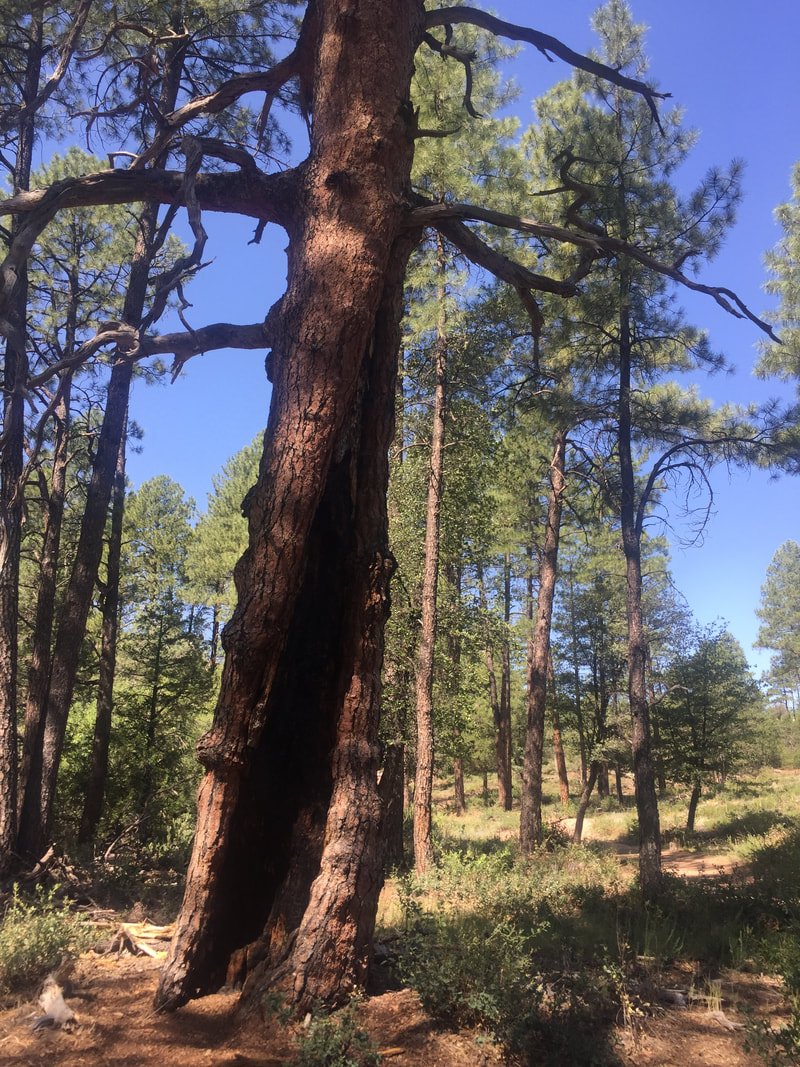
Ponderosa pines and the Tonto National Forest surround Payson.
Hikers and mountain bikers can find a network of trails on the perimeter of Payson in the Tonto National Forest. I found a level and shaded route along the Cypress and Boulders trails on the southeast edge of town off Phoenix Street. See details at https://www.paysonrimcountry.com/hiking-trails Green Valley renamed Payson in 1884 Payson was founded in 1882 as Green Valley, but the name was changed to Payson two years later after Illinois Congressman Levi Joseph Payson helped the town establish a post office. Supposedly, the caveat was that the town would take his name.. Payson, surrounded by vast national forests, has a history of logging. The Owens family operated a sawmill from 1951-58, when Kaibab Industries took it over. The mill closed in 1993. Payson was long isolated because of inadequate roads. In the 1930s, it took 8 to 12 hours to drive from Phoenix to Payson on the Bush Highway and old Globe Road. Construction of the Beeline Highway (State Route 87) started in the 1950s and a paved route was not completed until July 1958. https://rimcountrymuseum.org/a-highway-comes-to-payson/ The Beeline opened up Payson and the Rim Country as a weekend and summer destination for desert dwellers with high country cabins. It takes close to 90 minutes now to reach Payson from Phoenix. Founded: 1882 Elevation: 5,003 feet Population: 15,947 |
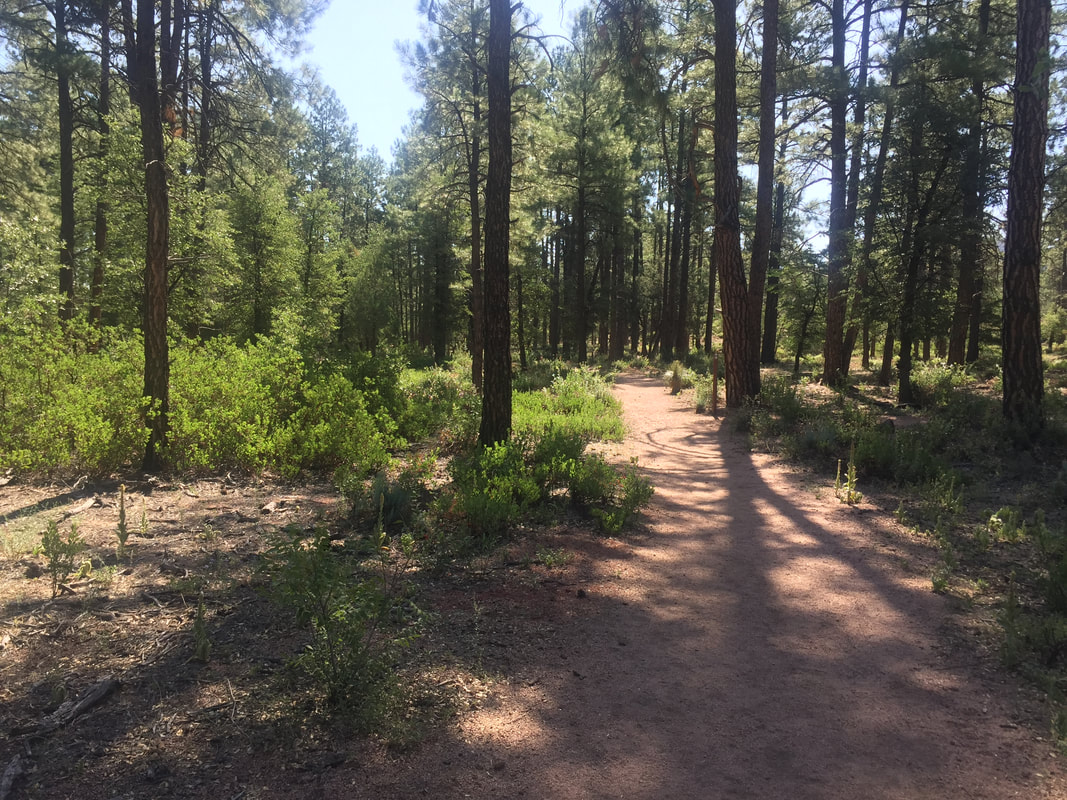
Cypress Trail on the southeast edge of town is flat and shaded.
|
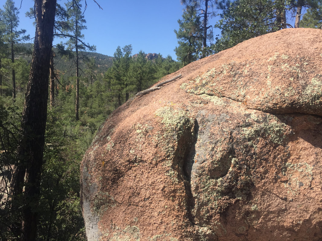
Naturally, there are boulders along the Boulders Trail.
|
Horton Creek trailhead is about 17 miles east of Payson, just past mile post 269.
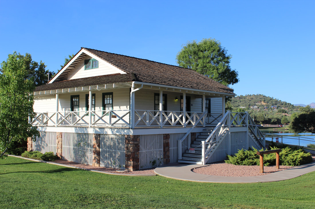
Western author Zane Grey's original cabin, built in 1921 east of Payson, was ruined by the 1990 Dude Fire but rebuilt in 2005 at Green Valley Park.
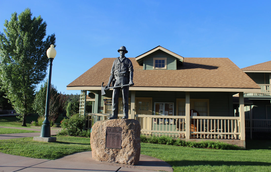
Six firefighters killed in the 1990 Dude Fire are honored at this memorial outside the Rim Country Museum in Green Valley Park.
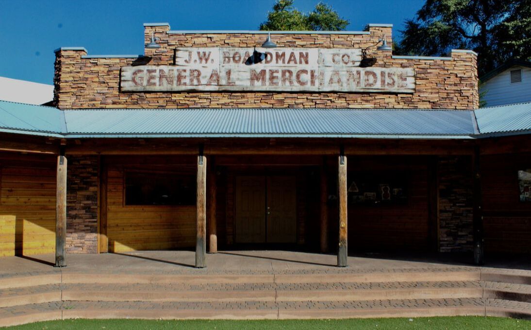
Boardman's general store was the town's first stone building circa 1900.
|
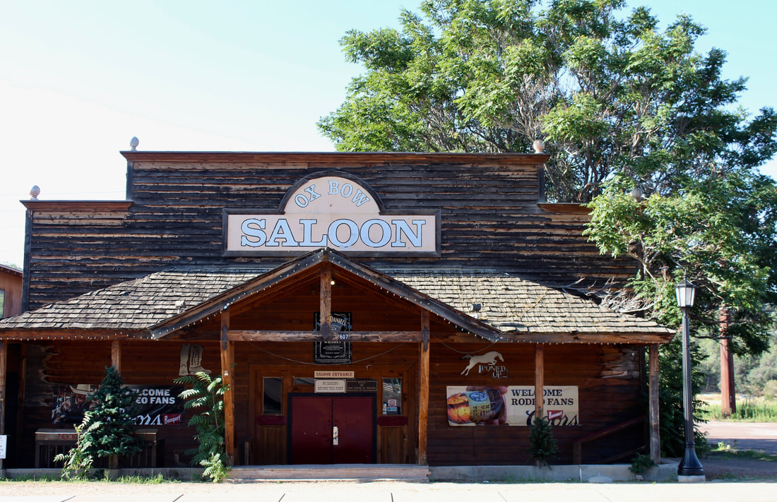
Ox Bow Saloon, 607 W. Main St., has been slinging drinks since 1945.
|
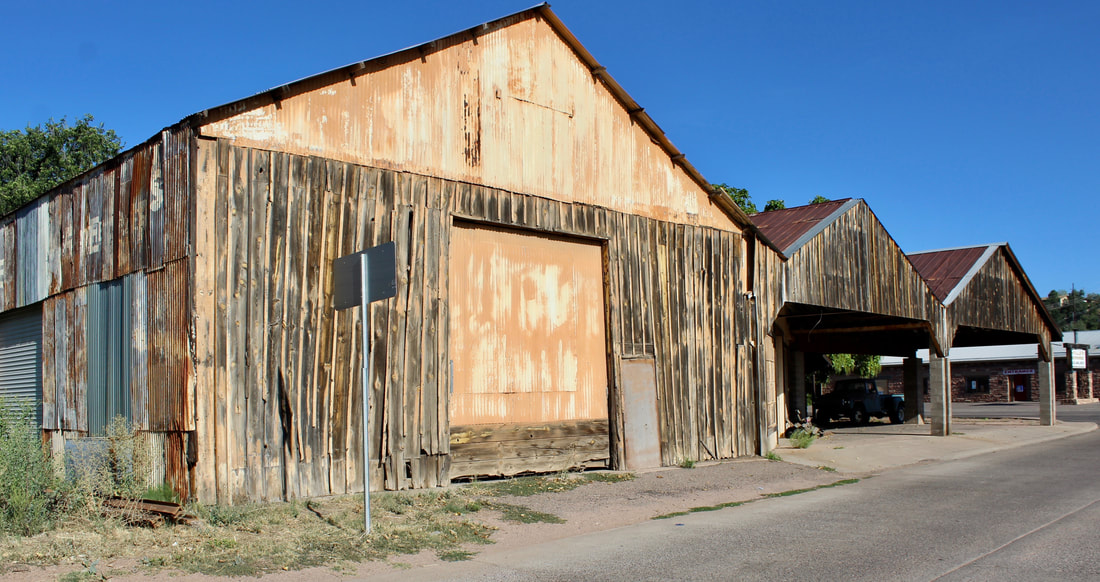
Grady Harrison (1891-1977) operated this garage, built in the 1930s at Main Street and McLane Road, and a trucking outfit that hauled freight from Globe.
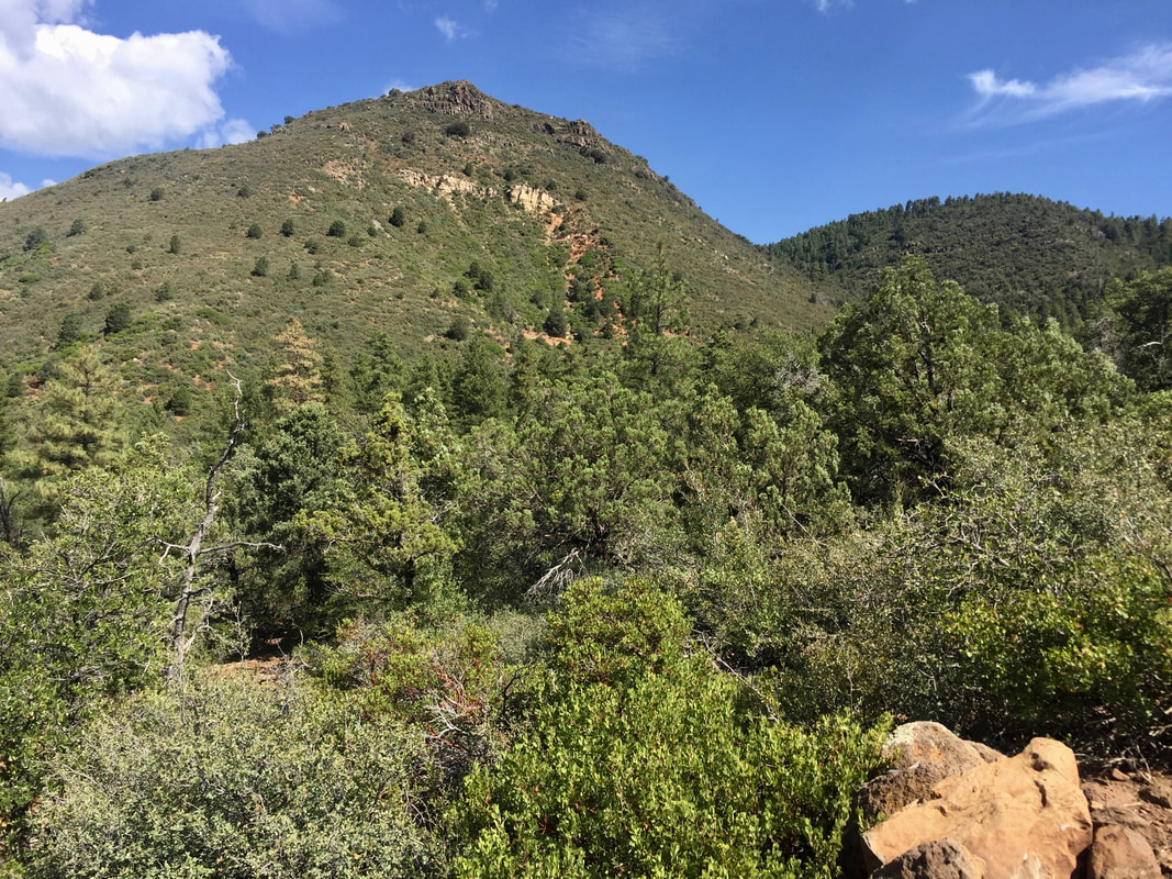
The Payson area is known as the Rim Country for the Mogollon Rim, an east-west escarpment generally north and east of the town.